Brunei Townships
- Territory Guide
- TITLE
Unlock the full potential of geo analysis by adding Brunei townships to your maps. Whether you’re managing logistics, optimizing sales territories, or conducting market research, adding Brunei townships offers valuable insights into local market dynamics and distribution networks.
By visualizing town boundaries, businesses can streamline operations, identify growth opportunities, and enhance decision-making processes. Here’s how to get started!
WHAT ARE BRUNEI TOWNSHIPS?
Brunei townships refers to administrative divisions within the counties of Brunei Darussalam. For businesses operating in Brunei, adding township boundaries to a Mapline map can provide crucial insights into local market segmentation, customer distribution, and service coverage areas.
For instance, a sales team could leverage township data to target specific customer demographics, tailor marketing campaigns, and identify areas with high sales potential.
Incorporating Brunei townships into your Mapline map enables you to enhance operational efficiency and strategic planning.
ADD BRUNEI TOWNSHIPS
it only takes a few seconds to add Brunei townships to your map, giving you near-instant access to the analytics data you need.
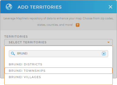
First, add a new territory from Mapline’s repository. Type BRUNEI in the searchbar and select BRUNEI TOWNSHIPS.
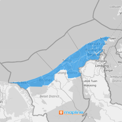
And just like that, you’ve added the right territory to your map! Now, let’s learn how to quickly select the type of territory colors you need.


Pro Tip: ONLY INCLUDE A PRO TIP IF THERE’S USEFUL OR VITAL INFORMATION USERS NEED TO KNOW.
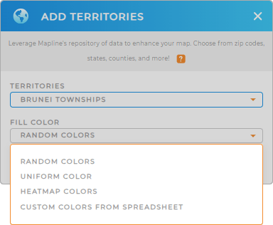
CHOOSE TOWNSHIP COLORS
Custom-colored territories empower you to get to the bottom of your data as fast as possible. Easily identify territories at a glance, segment territories according to your data, or custom color-code territories based on your own criteria.
Just select the type of color-coding you need, thenk click OK.
Fastest. Territory map. Ever.

GET NEW TERRITORY INSIGHTS
But that’s not all! Now, you can dig deeper into your territories and unveil new insights like never before. Here’s how:
- Segment your data and hone in on the exact insights you need
- Custom-style your territories so your map colors updates with your data
- Color-code your map pins according to sales data, team performance, or any other data you have


