KUWAIT GOVERNORATES
- Territory Guide
- KUWAIT GOVERNORATES
A map of Kuwait governorates helps significantly in data analysis. Each governorate provides its distinct characteristics. By understanding each of them, you get to tailor your approach accordingly. You identify new markets, get to the heart of your existing customers, and effectively expand your network to achieve greater success.
Bring forward your A-game as you create a map of Kuwait governorates. Let’s start now!
WHAT ARE KUWAIT GOVERNORATES?
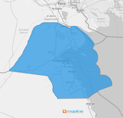
Kuwait is a small Arabian country located in West Asia. It is divided into six governorates or provinces. By visualizing this territory, you can uncover insights for data-driven decisions and push ahead for more effective market research, local partnerships, and tailored marketing.
It only takes a few clicks of your mouse to finish the two required steps of adding Kuwait governorates to your map.
ADD KUWAIT GOVERNORATES
Visualize your data on a map of Kuwait governorates! Analyze spatial patterns and make data-driven decisions to help skyrocket your strategies to achieve business success.
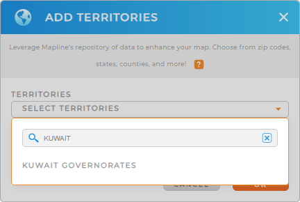
First, add a new territory from Mapline’s repository. Access it when you click the ADD button on the left side of your map then click TERRITORIES. Type KUWAIT into the search bar, and select KUWAIT GOVERNORATES.
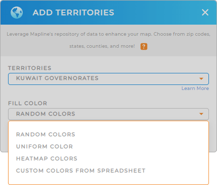
The next step is to choose the fill color for your territory.


Pro Tip: Mapline’s repository of worldwide territory boundaries including Kuwait governorates is ideal if you want to incorporate different regional boundaries into your map and monitor your business performance across the globe.
CHOOSE GOVERNORATE COLORS
A color-coded territory map is a game changer regarding territory segmentation. Assign colors to visually separate governorate boundaries. Assigning distinct colors to governorate territory enhances clarity, allowing for more effective analysis and decision-making.
To choose the appropriate color styles, Mapline provides static or dynamic colors to differentiate governorate boundaries or data values.
Hit OK and you now have your map of Kuwait governorates ready to be analyzed! Wow, that’s lightning-fast, right?

GET NEW TERRITORY INSIGHTS
Get your hands busy using your map of Kuwait governorates by adding these advanced capabilities:
- Optimize vehicle service area assignments thru advanced route optimization
- Understand each region’s performance with detailed reports
- Sort your data by highest performing stores or by sales rep


