
Laos District Map Busts The Challenges of Territory Planning
Enjoy the Benefits of Mapping the Districts of Laos
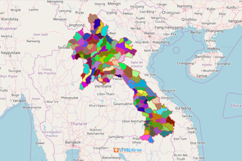
The local government units depend largely on a Laos district map to understand the capacities of each district. Laos is divided into 18 provinces. These provinces are further divided into districts. There are around 141 districts in Laos. Thus, the usage of a map with district boundaries is highly imperative for planning. Local governments would like to ensure that they perform their functions well. Some tasks that they shoulder include police force, and supervision of schools, hospitals, and roadways.
Needless to say, without territory mapping, planning would be very challenging. However, Mapline makes it possible to have user-friendly territory maps. With just a few clicks, location data from each district is clearly visible. In this way, it is easier to figure out what makes one area successful. In the same manner, the local government offices use data and map territories to plan ahead and bust the challenges brought by territory planning.
Seconds Away to Create a Map of Laos Districts
Bust the myth of exhausting territory planning. Analyze data in minutes and not days or even weeks. Use the right tools from Mapline. Enjoy the time-efficient way in creating territory maps in just 10 steps:
- Create a Mapline account and login.
- Click the orange “Add New Items” button.
- Select “New Map” on the drop down arrow.
- Give your map a name and click “OK.”
- Click the “Add” button from the left sidebar.
- Select the “Territories” option.
- Click “From Mapline’s Repository.”
- From the “Territories” select “Laos Districts.” You can also enter that on the search bar.
- Select how you want your boundaries to be colored in “Fill Color” (Random Colors, Uniform Color, Dynamic heat map colors, or Custom colors from spreadsheet).
- Click “OK.”
Make sure that your territory maps guide you to risk mitigation and management. Sign up now to gain access to more powerful tools needed to bust the challenges in territory planning.