
Turn a Simple Mongolia District Map to a Powerful Data Visualization
Try a District-Level Mapping Data Analysis
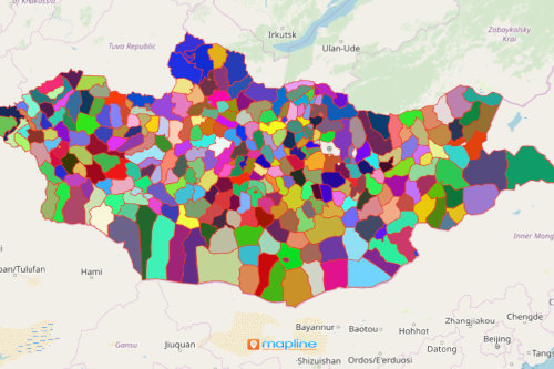
There is more to a Mongolia district map than meets the eye. Sure, you see a map with all its district borders. However, when you add an Excel spreadsheet of locations on the map, it becomes a whole new ball game! It shows patterns not only between district boundaries but also shows connections between locations and district borders. More than that, you’ll get to compare the relation of data from one district to another. These discoveries are essential when planning the crucial steps to take. Indeed, district-level mapping is important whether you are analyzing business growth, competition, or sales and marketing.
Make Your Excel Data Come Alive by Mapping the District Boundaries
Generating a district map is so easy to do. In fact, you can create it in just a few clicks!
- Create a Mapline account and login.
- Click the orange “Add New Items” button.
- Select “New Map” on the drop down arrow.
- Give your map a name and click “OK.”
- Click the “Add” button from the left sidebar.
- Select the “Territories” option.
- Click “From Mapline’s Repository.”
- From the “Territories” select “Mongolia Districts.” You can also enter that on the search bar.
- Select how you want your boundaries to be colored in “Fill Color” (Random Colors, Uniform Color, Dynamic heat map colors, or Custom colors from spreadsheet).
- Click “OK.”
Sign up now so you learn more tricks on how to turn your territory map into a powerful data visualization.