AUSTRALIA POSTAL CODES
- Territory Guide
- AUSTRALIA POSTAL CODES
Discover the power of adding Australia postal codes to your map! What once took hours or even days to analyze now happens in just minutes—or even seconds! Unlock patterns and relationships instantly for smarter, faster decision-making.
Territory mapping empowers you to refine your business strategies instantly. From streamlining delivery routes to targeting specific market segments, discover how mapping Australia postal codes can supercharge your success.
WHAT ARE AUSTRALIA POSTAL CODES?
Australian postal codes, also known as postcodes, are numerical codes used to facilitate mail delivery and sorting across different geographic areas within Australia. Each postcode typically corresponds to a specific region or locality. Introduced in 1967, Australian postcodes consist of four digits.
Today, Australian postcodes have widespread applications, including:
- Insurance companies use them to calculate insurance premiums for vehicles and properties.
- The Ministry of Transport assigns specific bus stop numbers based on postcodes.
- Sales and franchise companies utilize postcodes to delineate their operational territories.
- Government organizations such as the Bureau of Statistics and Taxation Office rely on postcodes for publishing statistical data organized by geographic regions.
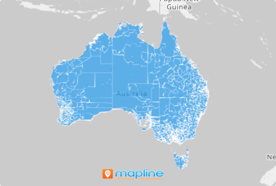
Unlock the power of advanced analytics with a dynamic postcode-level view across Australia! Visualize key insights on a detailed map, revealing hidden trends and game-changing opportunities.
ADD POSTAL CODES
When you incorporate boundaries like states or provinces, you may overlook crucial details that smaller boundaries, such as postal codes, can reveal. Luckily, Mapline offers this territory for use. With clearly defined boundaries, you’ll effortlessly spot crucial patterns that might otherwise go unnoticed—empowering you to make bold, strategic decisions that drive business success.
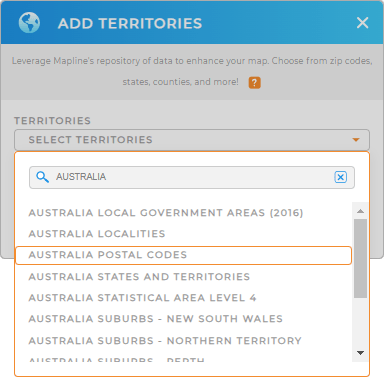
To get started, simply add a new territory from Mapline’s repository. Type AUSTRALIA in the search bar and select AUSTRALIA POSTAL CODES.
How easy was that?


Pro Tip: Mapline offers a variety of international territory boundaries, including those for Australia. Explore additional territories such as Australia states and territories, Australia suburbs, or Australia local government areas. Leverage Australia boundaries to discover new opportunities for informed decision-making.
CHOOSE POSTAL CODE COLORS
Enhance your map by adding colors. Colors not only add visual appeal but also unlock valuable insights for informed decision-making. These insights can be instrumental when analyzing marketing trends, customer behavior, and other economic metrics.
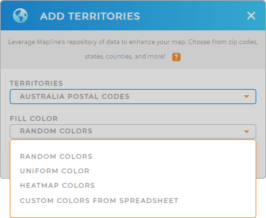
Select the color styles that best suits your needs. Choose from random colors, custom colors from your spreadsheet, heat map colors, or uniform colors.

GET NEW TERRITORY INSIGHTS
Now that you’ve created your map of Australian postal codes, let’s explore some key features:
- Visualize overlapping areas with precision using heat maps
- Uncover connections and correlations by integrating existing data into your territory
- Analyze and refine sales routes for optimal efficiency


