AUSTRIA STATES
- Territory Guide
- AUSTRIA STATES
A map of Austria states supercharged your logistics operations by providing clear, actionable insights. By visualizing these regions, you can identify high-demand areas, optimize delivery routes, or manage your resources more efficiently. When you know exactly which states need more attention and which ones are operating smoothly, you’re empowered to anticipate challenges, pivot strategies in the moment, and ensure timeliness across the board.
Let’s check out how to add Austria states to your map so you can streamline your logistics and boost your overall efficiency.
WHAT ARE AUSTRIA STATES?
Austria states, known as Bundesländer, are the main regional divisions within the country, similar to states in the USA. Mapping these states can help you identify regions with frequent service requests, optimize technician dispatch routes, and ensure that your resources are deployed efficiently.
By using maps of Austria states, you can see which areas have the highest service demands and adjust your operations accordingly. This level of detail allows you to prioritize urgent requests and optimize your daily operations. Visualizing Austria states can transform your logistics strategy by providing detailed insights into each region’s performance and helping you stay ahead of any potential issues.
ADD AUSTRIA STATES
A map of Austria states is a powerful way to get a high-level overview of your logistics within each state, helping you make data-driven decisions that can streamline operations and minimize expenses.
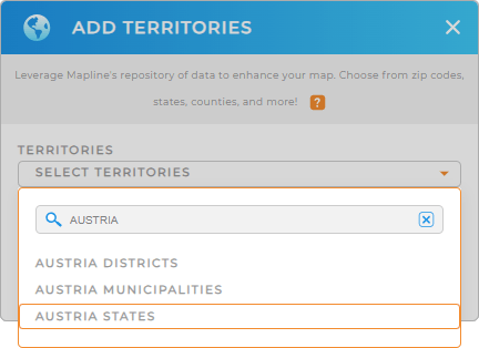
First, add a new territory from Mapline’s repository, type AUSTRIA into the search bar, and select AUSTRIA STATES.
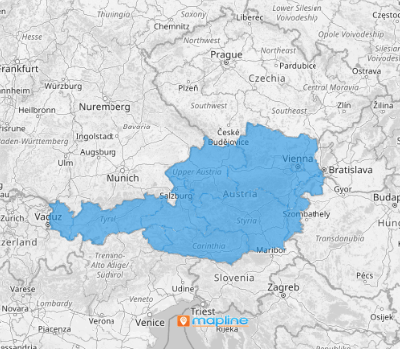
And BAM! You’re about to gain an accurate and detailed representation of your logistical regions. There’s just one more quick step, and you’re done.


Pro Tip: Mapline’s extensive list of territory boundaries allows you to add precise regional divisions to your map. Leverage our worldwide territory repository to explore other regions in the country, including Austria districts, Austria states, and Austria municipalities.
CHOOSE STATE COLORS
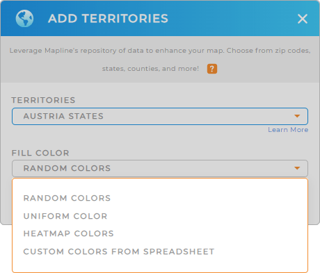
Territory colors are essential on your map, as they empower you hone in on performance metrics at a glance. Color-code your Austria states to quickly identify customer hotspots and analyze market trends.
Just select your desired color styling and click OK.
This powerful visual tool enhances your ability to make strategic decisions based on clear, color-coded data, ensuring smooth, streamlined operations.

GET NEW TERRITORY INSIGHTS
Unlock more valuable insights that were previously hidden in your data by using these powerful capabilities:
- Analyze service response times across different states to identify areas for improvement
- Segment your service data to focus on regions with the highest maintenance needs
- Create custom dashboards with maps and metrics to discover patterns in service requests and predict future demand


