BENIN DEPARTMENTS
- Territory Guide
- BENIN DEPARTMENTS
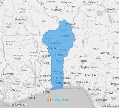
Transform your daily sales strategies as you add Benin departments to your map. By adding a map of departments into your sales analysis, you’re not just adding a layer to your strategy—you’re sharpening your focus like never before. Each department on the map provides a clear, detailed view of your sales performance across the entire region. Imagine having to discover your sales performance in finer detail! With this detailed insight, you can see where your business is thriving and where it needs a boost.
Make data-driven decisions that propel your business forward. Start now as you add these boundaries to your map in less than a minute.
WHAT ARE BENIN DEPARTMENTS?
Formerly known as Dahomey, Benin is a West African country divided into 12 departments. Visualizing these administrative divisions allows brands to gain a deeper understanding of market dynamics. You may be surprised to discover trends and patterns that might not be obvious from raw data alone. That’s the power of visualization as you add department boundaries to your map!
Gain location insights as you leverage a department territory map to drive sales growth, increase revenue, and exceed targets.
ADD BENIN DEPARTMENTS
Let’s say you’re a food producer and distributor and your business spans across all of Benin. Leveraging a department-level map is a big help to identify the most efficient routes for delivering perishable goods. By visualizing customer locations and delivery points, you can seamlessly plan routes that minimize travel time and ensure timely deliveries, reducing spoilage and improving customer satisfaction.
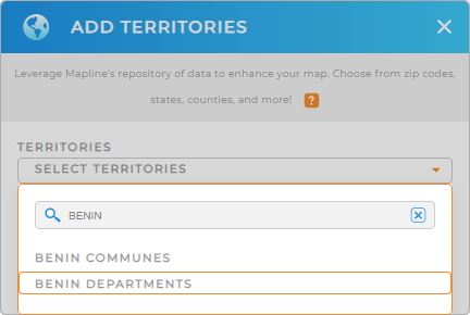
Is that awesome or what? To do that, first, add a new territory from Mapline’s repository. In the search bar, type BENIN and select BENIN DEPARTMENTS.
Now that you have chosen the right territory to add, let’s get your map color-coded.


Pro Tip: Mapline’s Repository provides a comprehensive list of territory boundaries including Benin communes and departments. Go ahead and add different boundaries to your map to explore regional trends and enhance your strategic analysis capabilities.
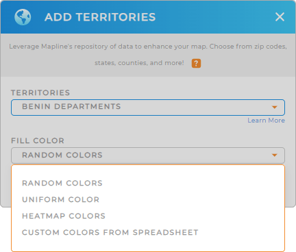
CHOOSE DEPARTMENT COLORS
Why color-code your map? Simply because colors are an important factor in your analysis. They help ignite ideas that may be hidden behind your data. You can either choose static colors to make the department boundaries easily distinguishable. On the other hand, dynamic colors are to be chosen if you want your data tied to them to help you identify patterns and insights for informed decision-making. By thoughtfully selecting and applying color styles, you can enhance your data and territory analysis, making it more intuitive, informative, and impactful.
Once you have configured the color styling to suit your analysis, click OK.

GET NEW TERRITORY INSIGHTS
Unleash the full potential of your map by navigating your analysis using these capabilities:
- Visualize data density across different departments to identify high-performing areas
- Seamlessly generate efficient routes in seconds
- Build a system that analyzes your customers in minutes


