Brazil Municipalities
- Territory Guide
- Brazil Municipalities
Elevate your analytics game and delve into the power of a Brazil municipalities map. Whether you’re navigating complex logistics, refining sales strategies, or optimizing marketing campaigns, mapping at the municipal level offers unparalleled insights.
With Mapline, you can dive deep into local nuances and uncover opportunities and challenges that might otherwise go unnoticed.
From pinpointing delivery routes to targeting specific customer segments, the granularity of municipal-level mapping empowers you to make data-driven decisions with precision. So why wait? Take a few minutes to unlock the full potential of your map now!
WHAT ARE BRAZIL MUNICIPALITIES?
Brazil municipalities are administrative subdivisions that play a crucial role in business operations within the country. With over 5,500 municipalities across Brazil, these boundaries provide a granular view of geographic areas, enabling businesses to tailor their strategies to local market conditions.
For instance, sales and marketing teams can leverage municipality boundaries to target specific demographics and consumer segments, allowing for more precise advertising and promotional campaigns.
By mapping Brazil municipalities, businesses gain insights into regional variations in customer preferences, competition levels, and economic activity, enabling them to make informed decisions and maximize their market penetration and revenue generation efforts.
ADD BRAZIL MUNICIPALITIES
Add Brazil municipalities to your map in seconds! This makes it easy to identify potential market challenges and empower your team to go above and beyond.
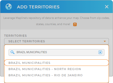
First, add a new territory from Mapline’s repository. Then, type BRAZIL MUNICIPALITIES into the searchbar and select BRAZIL MUNICIPALITIES.
It’s never been easier to map valuable territories–and it only takes a few clicks!


Pro Tip: Mapline’s Repository provides a long list of territory boundaries for Brazil. You can easily overlay other territory boundaries, such as Brazil cities, Brazil zip codes, Brazil neighborhoods, or Brazil regions.
CHOOSE MUNICIPALITY COLORS
A territory map with colors exudes a powerful visual that easily ignites ideas relevant to your analysis. Take these ideas and apply them as you create plans for future business growth, market research, and sales productivity.
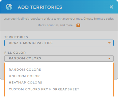
Select the type of colors you’d like on your map.
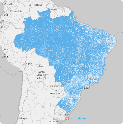
Click OK and there you have it! Your map of Brazil municipalities is ready to go.

GET NEW TERRITORY INSIGHTS
What else can you do with your map of Brazil municipalities? Here are some great ways to do more with your data:
- Reveal new geo-insights with coverage circles
- Label your territories by team name for easy identification
- Access key data within each municipality with folder reports


