BRUNEI VILLAGES
- Territory Guide
- BRUNEI VILLAGES
Adding Brunei villages to your map can transform how you manage and optimize your field operations. By visualizing these villages, you can pinpoint high-demand areas and efficiently allocate resources. This type of territory mapping is essential for tailoring your strategies to meet local needs. With a clear view of each village’s data, you can streamline your operations and enhance overall productivity.
Ready to boost your efficiency with precise, actionable insights? Let’s get started!
WHAT ARE BRUNEI VILLAGES?
Brunei is divided into smaller administrative units known as villages, or “kampongs.” Each village has its unique demographic and geographic characteristics that can influence your business decisions. Mapping Brunei’s villages allows you to analyze local performance and identify areas needing attention. This type of territory mapping can significantly improve your ability to manage logistics and optimize resource distribution. By leveraging these insights, you can ensure that your operations run smoothly and effectively, meeting the specific needs of each village.
ADD BRUNEI VILLAGES
Add Brunei villages to your map to gain enhanced visibility into local performance so you can optimize your operations. This important step allows you to spot hidden patterns, anticipate trends, and refine your approach with laser-sharp precision.
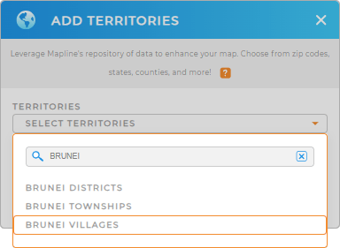
First, add a new territory from Mapline’s repository, type BRUNEI into the search bar, and select BRUNEI VILLAGES. This step is essential for creating a customized map that meets your specific needs and helps you identify areas of improvement.


Pro Tip: Mapline’s extensive repository of territory boundaries allows you to add regions from various countries to your map, expanding your operational capabilities globally. Explore different territories, including Brunei townships, Brunei districts, and villages, then compare to contrast regions!
CHOOSE VILLAGE COLORS
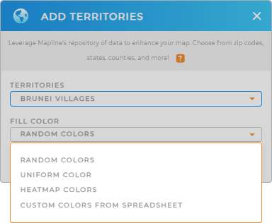
Color-coding your Brunei villages is crucial for clear and effective data visualization. By assigning different colors to each village, you can quickly identify performance trends and optimize your operations.
Select your desired color styling, then click OK.
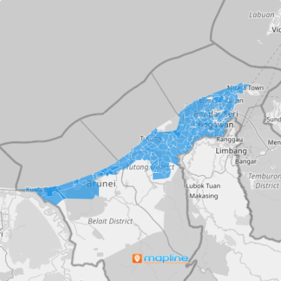
Woah! You just enhanced the power of your map, making it easier to analyze data and make informed decisions at a glance.

GET NEW TERRITORY INSIGHTS
Now, you can unlock rich insights previously hidden in your data by leveraging these powerful capabilities:
- Identify areas with the highest demand for services and allocate resources accordingly
- Optimize your delivery routes for the utmost efficiency in each region
- Analyze local performance metrics to improve overall operational strategies


