CAMEROON REGIONS
- Territory Guide
- CAMEROON REGIONS
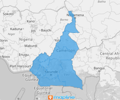
Experience the efficiency of creating a map of Cameroon regions, taking just 60 seconds or less! Mapping these administrative divisions opens the door to deeper analysis, making it an invaluable tool for enhancing customer engagement. By focusing on analysis at a regional level, you can capture key factors that influence how you craft strategies to optimize customer service, refine strategic planning, and strengthen connections with your audience.
Get ready to transform your strategy and enhance your operations today! This quick and easy process unlocks powerful insights, allowing you to streamline your approach much better.
WHAT ARE CAMEROON REGIONS?
Cameroon, a vibrant West African country, is divided into 10 semi-autonomous regions. These regions provide a sneak peek of different major towns, including Yaoundé, the political capital, and Douala, the major economic city. Discover high-potential areas within regional boundaries to gain a strategic advantage and make smarter decisions. Tap into new markets and promote services that best serve the population.
Start building your dynamic map of Cameroon regions today and watch your insights come to life!
ADD CAMEROON REGIONS
Mapping Cameroon regions is crucial for pinpointing areas with high customer service demand, allowing you to deploy resources effectively. By doing so, you ensure that customer needs are met promptly, enhancing satisfaction and fostering loyalty.
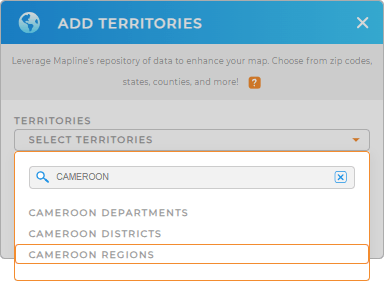
Add a new territory from Mapline’s repository by clicking the ADD button at the left side of your map. Then, in the search bar, type CAMEROON and select CAMEROON REGIONS.
Just by doing that, you’re halfway into transforming your approach to crafting successful business strategies with targeted insights that drive your business forward!


Pro Tip: Mapline’s comprehensive repository of detailed territory boundaries includes Cameroon regions, Cameroon departments, and Cameroon districts. By incorporating these precise boundaries into your map, you can amplify your analysis and uncover valuable insights that drive your decision-making.
CHOOSE REGION COLORS
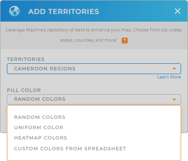
Color-code your map to unlock deeper insights and actionable intelligence! Choose between static or dynamic colors to fill your territories, with heat map colors being an excellent option for visualizing performance disparities. This style allows you to easily identify areas that are thriving versus those that are underperforming.
Applying the right color styles can spark new ideas and strategies. Imagine that in just a few clicks, you can transform your data visualization into a powerful tool for growth!

GET NEW TERRITORY INSIGHTS
Leverage these powerful capabilities and tap into new insights to maximize the use of your map of Cameroon regions:
- Understand where the majority of your activity is located through radius-based heat map
- Instantly add new locations to your dataset
- Segment your customers to visualize active vs inactive customers


