CHINA PROVINCES
- Territory Guide
- CHINA PROVINCES
Transform your business strategy by adding China provinces to your map and unlock a powerhouse of insights. Visualizing your business performance across China’s provinces is like wielding a precision tool for your business. It allows you to pinpoint exactly where your operations are excelling and identify regions where there’s room for improvement. Imagine having the ability to see your performance across each province, revealing critical insights into geographical strengths and weaknesses. This level of detail helps you understand which areas are driving growth and which might need a strategic boost.
Get ready to steer your business with confidence through the vast landscape of China!
WHAT ARE CHINA PROVINCES?
The People’s Republic of China boasts a distinctive and intricate structure of administrative divisions. It comprises 22 provinces, each playing a crucial role in the country’s governance and administration. Additionally, Hong Kong and Macau function as Special Administrative Regions, adding another layer of complexity to the nation’s administrative landscape.
By incorporating these administrative layers into your mapping, you gain a comprehensive view that helps you navigate China’s diverse markets with precision. Whether you’re focusing on provincial trends, metropolitan areas, or autonomous regions, this detailed approach allows you to tailor your strategies and make well-informed decisions across the entire country.
ADD CHINA PROVINCES
Make a province territory map your game plan to focus on areas that need the most attention. By visualizing these detailed province boundaries, you can achieve better insights into your business coverage.
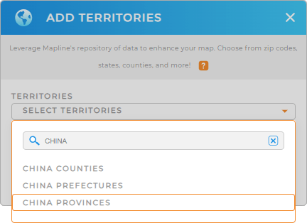
Adding China provinces takes only a few seconds. All you need to do is to add a new territory from Mapline’s repository. Type CHINA into the search bar and select CHINA PROVINCES.
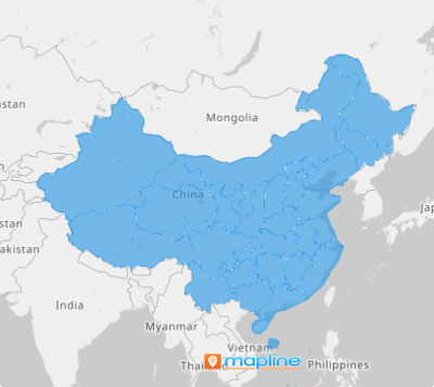
Almost in a blink of an eye and you have added the territory to your map!


Pro Tip: Explore Mapline’s comprehensive territory repository to gain insights into China to enhance your strategic planning capabilities. Add administrative boundaries including China China prefectures, China counties, and provinces to your map now!
CHOOSE PROVINCE COLORS
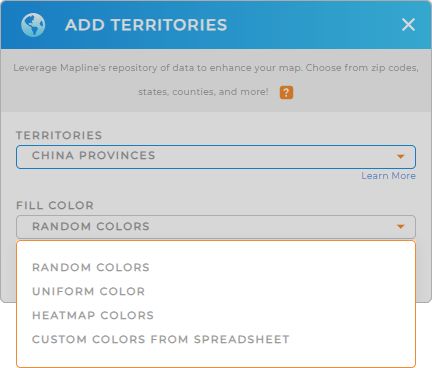
Now, the next step is to apply color styles to your territory. A color-coded territory map is a powerful analytic tool that evokes insights, enabling quick identification of regional trends, patterns, and performance metrics.
Mapline provides comprehensive color style selections that meet your type of analysis. Simply select your preferred color styling from the drop-down menu – random colors, uniform color, heat map colors, or custom colors.
When you’re done configuring your territory colors, click OK.

GET NEW TERRITORY INSIGHTS
Skyrocket your analytics as you embark on utilizing these powerful capabilities in your map of China provinces:
- Click the file column to quickly attach new files to your data
- Run complex calculations to uncover hidden trends
- Create cutting-edge route optimization


