COMOROS ISLANDS
- Territory Guide
- COMOROS ISLANDS
Harness the power of a Comoros Islands map to drive smarter decisions, streamline your operations, and unlock insights that fuel growth with clarity and precision. These islands aren’t just landmasses—they’re keys to understanding customer behavior, buying patterns, and shifting regional demand.
With geographic intelligence at your fingertips, your sales team can segment audiences with laser focus, craft region-specific outreach, and prioritize the territories primed for growth. Whether you’re fine-tuning logistics, launching a campaign, or optimizing service delivery, mapping Comoros gives you the edge to refine strategy, deepen engagement, and amplify your impact across every island.
Let the map of Comoros be your business advantage now!
WHAT ARE COMOROS ISLANDS?
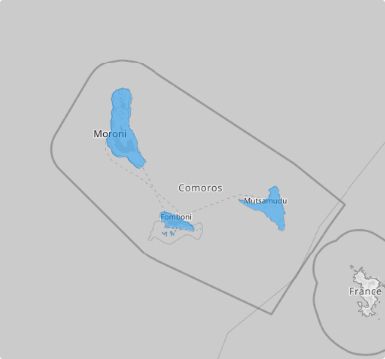
Comoros is an island nation in Southeastern Africa, a trio of volcanic gems rising from the Indian Ocean. Tucked at the northern mouth of the Mozambique Channel, this archipelago may be small—just 1,659 km² in size—but it pulses with rich culture, striking landscapes, and deep-rooted identity. The Union of the Comoros brings together three main islands: Grande Comore, Mohéli, and Anjouan—each with its own unique charm. Nearby Mayotte is part of the Comoros archipelago but remains politically separate. Strategically located off Africa’s east coast, the Union is proudly part of the African Union and stands as one of the continent’s most fascinating island nations.
Using a map of the Comoros Islands can significantly boost a brand’s logistics, sales, marketing, and business operations by providing strategic geographic insights. Unlock smarter sales strategies when you add a map of Comoros Islands to your analytical tool!
ADD COMOROS ISLANDS
Now, turn geographic context into actionable strategy—enabling smarter decisions that are rooted in place and tailored for impact when you map these islands. With access to its islands, you can uncover hyper-local insights that drive real results.
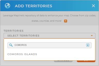
To do that, just add a new territory from Mapline’s repository. In the searchbar, type COMOROS to add COMOROS ISLANDS to your map very quickly.


Pro Tip: Planning a market expansion across Africa? Layer in surrounding territories to reveal cross-border opportunities, pinpoint high-demand zones, and align your logistics with real-world geography. With Mapline’s global boundary repository, every boundary becomes a blueprint for growth.
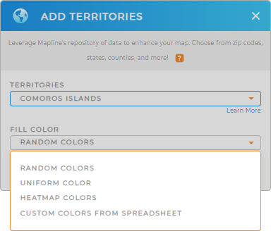
CHOOSE ISLAND COLORS
Take your business to the next level with the power of detailed territorial insights! Empower strategic decisions with a map that does more than show locations—it reveals performance. With smart territory colors, you can instantly spot high-growth zones, monitor trends, and align regional strategies with company goals—all in one view.
Choose the right color styles to transform your map from a basic visual into a powerful decision-making tool that reveals patterns, highlights priorities, and drives action with instant clarity.

GET NEW TERRITORY INSIGHTS
Now, turn your map of Comoros Islands into a game-changer by applying these powerful analytical capabilities:
- Draw custom boundaries to get an in-depth look at the impact of geographic factors on your business
- Instantly sync your Google Ads account with your Mapline dashboard to get real-time visibility into territories
- Organize your data like a pro to easily spot trends and insights


