ENGLAND COUNTIES
- Territory Guide
- ENGLAND COUNTIES
Add England counties to your Mapline map and dive deeper into your data analysis. This is a fantastic way to uncover valuable insights right down to the county level.
Let’s say you’re a sales team looking to optimize territory management across England. By incorporating England Counties into your Mapline map, you can precisely visualize your sales territories, identify key areas for expansion, and strategically allocate resources for maximum sales impact. Whether you’re targeting specific regions or evaluating market penetration, you’ll be empowered to make smarter decisions and drive business growth like never before.
WHAT ARE ENGLAND COUNTIES?
England counties are administrative divisions within England, each representing a specific geographic area. There are a total of 48 counties in England, each with its own distinct boundaries and local government. These counties serve various purposes, including governance, planning, and statistical analysis.
By incorporating England counties into their Mapline map, you can visualize the distribution of customers and prospects across different counties. This allows you to segment your target market more effectively and tailor your sales strategies to meet the specific needs of each county.
With better insights into regional sales performance and customer demographics, you can identify opportunities for growth, improve customer engagement, and ultimately drive revenue growth.
ADD ENGLAND COUNTIES
Enhance your location analysis by easily incorporating England county territories into your map!
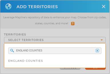
First, add a new territory from Mapline’s Repository. Type ENGLAND in the search bar and select ENGLAND COUNTIES.
That didn’t take long! Let’s check out the next step.


Pro Tip: In addition to England counties, Mapline’s Repository provides various territory boundaries for the United Kingdom. Explore other territories like England regions, London boroughs, and London wards to gain comprehensive insights into your geographic data.
CHOOSE COUNTY COLORS
Enhance the visual appeal and functionality of your map by experimenting with color styling options.
Whether you’re mapping for analytics or presentation purposes, custom-colored styling makes your England counties map both informative and visually engaging.
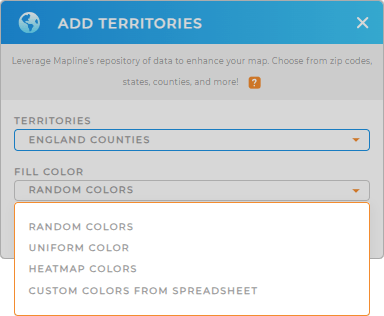
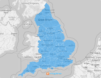
Choose from random, uniform, heatmap, or custom colors and click OK. Now, your map is ready for in-depth territory analysis!

GET NEW TERRITORY INSIGHTS
Get more from your England counties map. Here are some different examples of how brands leverage their maps:
- Efficiently track on-site data for team compliance
- Spot growth opportunities by adding coverage areas
- Import demographic data onto your map in seconds!


