Equatorial Guinea Municipalities
- Territory Guide
- Equatorial Guinea Municipalities
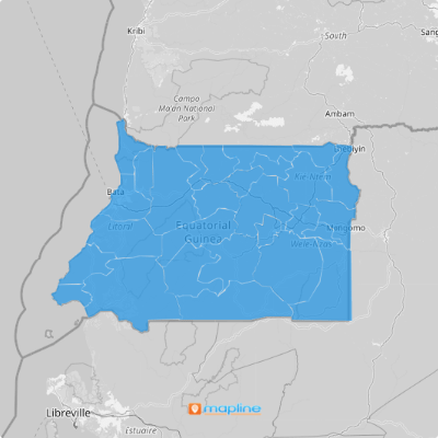
A map of Equatorial Guinea municipalities is essential for businesses seeking to establish a robust operational framework. By incorporating Equatorial Guinea’s municipal boundaries into your maps, you’ll gain crucial insights into regional demographics, market potential, resource allocation, and more.
Whether you’re optimizing supply chains, targeting specific consumer segments, or expanding market reach, leveraging municipal maps equips you with the geo intelligence necessary for informed decision-making and driving growth.
WHAT ARE EQUATORIAL GUINEA MUNICIPALITIES?
Equatorial Guinea’s municipalities, numbering 32 in total, are crucial administrative divisions stemming from the country’s 19 districts and 8 provinces. These municipal boundaries offer invaluable insights into local market dynamics, customer distribution, and operational logistics.
For instance, a logistics company could optimize delivery routes within municipal boundaries, empowering newfound levels of efficiency. Or, a sales team could target specific municipalities for tailored campaigns based on demographic and socioeconomic factors. Incorporating Equatorial Guinea’s municipal boundaries is a powerful way to level-up your operations and analytics.
ADD MUNICIPALITIES TO MAP
Add the municipalities of Equatorial Guinea to your map with just a few clicks of your mouse!
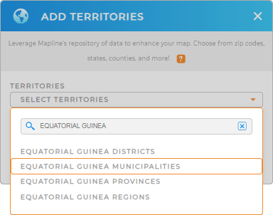
First, add a new territory from Mapline’s repository. Then, type EQUATORIAL GUINEA into the searchbar and select EQUATORIAL GUINEA MUNICIPALITIES from the drop-down menu.
And there you have it! It’s that easy. Let’s move on to Step 2.


Pro Tip: Tap into Mapline’s vast territory repository to add more Equatorial Guinea territories including municipalities, Equatorial Guinea provinces, Equatorial Guinea regions, and Equatorial Guinea districts, to your maps!
CHOOSE MUNICIPALITY COLORS
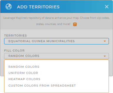
Next, gain new insights from your map of Equatorial Guinea municipalities with custom colors. Colors create a visual guide, empowering you to tap into key insights faster than ever.
Just select the type of color styling you need, then click OK. Now you’re ready to analyze!

GET NEW TERRITORY INSIGHTS
With your map ready to go, let’s chart a course for quick analysis:
- Sort your data to extract deeper insights
- Put the power of visualization at your fingertips with dashboards
- Leverage coverage areas to identify gaps in service


