EQUATORIAL GUINEA PROVINCES
- Territory Guide
- EQUATORIAL GUINEA PROVINCES
Add Equatorial Guinea provinces to your map and unleash the true potential of your data! Visualize regional trends and geographic patterns that affect your business strategies and literally see your audience in new ways. Tap into detailed visualizations that enable your team to create and manage efficient, location-based territories.
Mapping Equatorial Guinea’s provinces enhances your business analytics, helping you to identify new opportunities, optimize logistics, and improve your market penetration. Leverage these insights to stay competitive and drive business success. Check it out!
WHAT ARE EQUATORIAL GUINEA PROVINCES?
Equatorial Guinea is divided into several provinces, each with its own unique demographic and economic characteristics. These provinces are crucial for understanding local market dynamics, planning resources, and targeting customers effectively.
Businesses can use province-level analysis to tailor marketing strategies, streamline supply chains, and enhance customer service. Mapping these provinces provides a clear view of regional strengths and opportunities, facilitating better decision-making.
ADD PROVINCES TO MAP
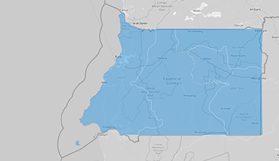
Integrating Equatorial Guinea’s provincial boundaries into your map allows for detailed analysis and strategic planning. This visual aid supports informed decision-making and enhances operational efficiency.
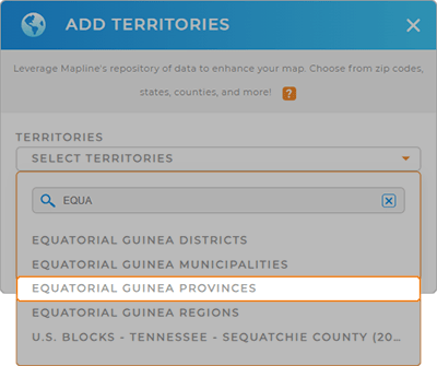
First, add a new territory from Mapline’s repository. Then, type EQUATORIAL into the searchbar and select EQUATORIAL GUINEA PROVINCES.
Woah, that was fast! You’re halfway there to generating a powerful map that helps you analyze regional dynamics and their impact on your brand.


Pro Tip: Dive into Mapline’s comprehensive territory repository to gain insights into other regions and enhance your strategic planning capabilities. Compare and contrast different government boundaries such as Equatorial Guinea districts, provinces, Equatorial Guinea regions, and Equatorial Guinea municipalities.
CHOOSE PROVINCE COLORS
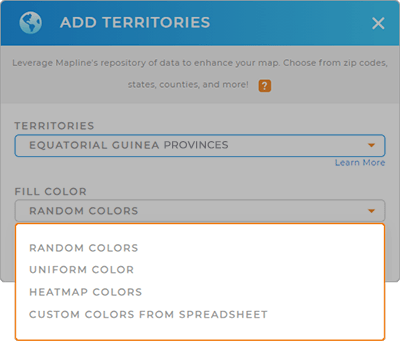
Color-coding Equatorial Guinea’s provinces is a fantastic way to level-up your data analytics, allowing you to quickly identify trends, analyze metrics, and identify areas needing attention.
Simply select your preferred color styling options, click OK, and your map is all set!
Now, you’re ready to dive deeper into your data analysis and understand your audience in new ways.

GET NEW TERRITORY INSIGHTS
Unlock deeper insights with Mapline’s advanced capabilities:
- Plan and optimize routes for your sales teams or deliveries to enhance efficiency and reduce costs
- Use Mapline Data to analyze distances between points, which can be crucial for logistics and planning
- Collaborate with team members or clients by sharing interactive maps to ensure everyone is on the same page


