ESTONIA COUNTIES
- Territory Guide
- ESTONIA COUNTIES
Elevate your location understanding by adding Estonia counties to your map. Detailed maps of county boundaries are incredibly beneficial for brands as they provide a more localized view compared to larger divisions like provinces or districts. This granularity allows you to pinpoint specific areas for market penetration and expansion within different counties.
Whether you’re in logistics, sales, or marketing, refining your operations with an Estonia county map offers unparalleled precision. This detailed geographical breakdown helps you better understand regional dynamics and tailor your strategies accordingly.
WHAT ARE ESTONIA COUNTIES?
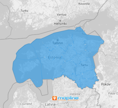
In Estonia, counties are the first-level administrative subdivisions, each governed by an appointed governor. Estonia is divided into 15 counties – 13 on the mainland and 2 on the islands. These counties are further subdivided into 213 municipalities. Each county has its unique demographic, economic, and cultural characteristics. Mapping these counties provides significant advantages for business analytics. For instance, Harju County, which includes the capital city of Tallinn, is a major economic and population center, making it crucial for businesses aiming to establish a strong market presence.
Integrating county boundaries into your maps enhances market penetration and business expansion efforts. A county territory map streamlines analysis and provides clearer insights into business directions, moving beyond the limitations of traditional spreadsheets. Check it out!
ADD ESTONIA COUNTIES
By mapping Estonia’s counties, you can identify key areas for growth, optimize resource allocation, and develop targeted strategies that drive better business outcomes.
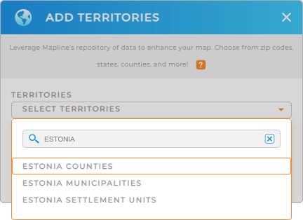
First, add a new territory from Mapline’s repository. Then, type ESTONIA in the searchbar and select ESTONIA COUNTIES.
Whether you’re planning marketing campaigns, or optimizing distribution networks, leveraging county territory map of Estonia empowers you with actionable insights to drive informed decision-making and business success.


Pro Tip: Tap into Mapline’s worldwide repository of pre-defined territory boundaries to uncover new insights! Compare and contrast how different administrative boundaries impact your business, including Estonia municipalities, and Estonia settlement units, and counties.
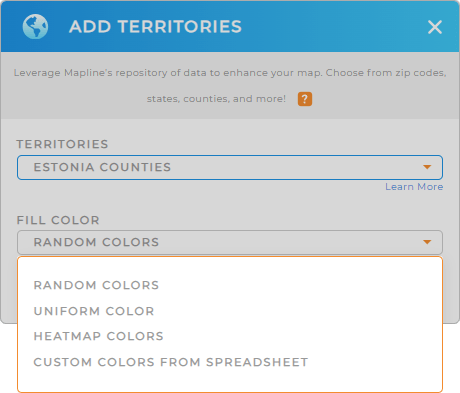
CHOOSE COUNTY COLORS
Colors play a pivotal role in analysis. They empower you to communicate complex information more intuitively, making patterns and trends easier to identify.
Simply select your desired type of color styling, click OK, and you’re all set!
What a powerful way to visually differentiate between your territories and key data points!

GET NEW TERRITORY INSIGHTS
Get the most out of your map of Estonia counties with these powerful capabilities:
- Visualize your service coverage areas and analyze the factors impacting sales
- Run advanced calculations, including formulas that don’t exist in Excel, to unveil new insights about your customers and operations
- Generate routes that optimize themselves and ensure nothing ever falls through the cracks


