
Strengthen Collaboration by Analyzing a Finland Region Map
Work Well with Other Councils Through Mapping
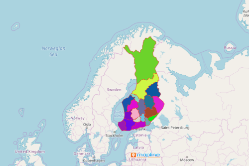
The regional councils use the Finland region map mainly for planning purposes. Finland is a country located in Europe. The country is divided into 19 regions. Each region has its council. Collaboration between the councils is important for smooth implementations of programs such as public health services, education, and enterprise. This is where mapping steps in. Mapline provides a regional boundary of Finland. In this way, they can track the progress of each implemented program.
A region-level data analysis is used to identify which regions need more support. In addition, the map can also pinpoint which region can assist others and in what way. Through mapping, collaboration and cooperation between local government units are strengthened. Maps can be shared. They can even be embedded to a website. A careful study of Finland region map leads to a positive outcome because location data and boundaries are used as solutions.
Reinforce Program Initiatives by Mapping the Regions
The needs of each region are ever changing through the times. It is the council’s responsibility to track the needs and find ways to solve them. Start mapping Finland regions n less than a minute!
- Create a Mapline account and login.
- Click the orange “Add New Items” button.
- Select “New Map” on the drop down arrow.
- Give your map a name and click “OK.”
- Click the “Add” button from the left sidebar.
- Select the “Territories” option.
- Click “From Mapline’s Repository.”
- From the “Territories” select “Finland Regions.” You can also enter that on the search bar.
- Select how you want your boundaries to be colored in “Fill Color” (Random Colors, Uniform Color, Dynamic heat map colors, or Custom colors from spreadsheet).
- Click “OK.”
Sign up now and learn more on how to conduct better strategic planning using other powerful mapping tools like heat maps, distance calculators, and supersets.