FRANCE CANTONS
- Territory Guide
- FRANCE CANTONS
Can you beat the growing competition just by looking at a map? With a map of France cantons, you can! There is so much more to see on this map. Mapline makes it possible to provide only the precise territory boundaries so you can identify the strengths and opportunities of your competitors with your own. Overlay the canton boundaries on your map and you’ll get to discover new opportunities and identify hidden challenges that can help run your operations seamlessly.
Get a competitive advantage in the market as you leverage a canton territory map now! Here’s the ideal way to kick-start your location analytics by creating a map of France cantons.
WHAT ARE FRANCE CANTONS?
France is made up of 342 districts which are divided into 2,054 cantons. Since cantons are small divisions, they are the ideal boundaries to locate your customers and understand their buying needs. A canton territory map also allows you to identify who your direct and indirect competitors are so you can make a move ahead of them.
Discover all these and more as you create a map of France cantons. After all, it only takes a few seconds to do that.
ADD FRANCE CANTONS TO MAP
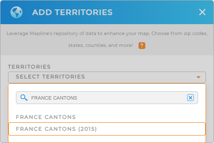
Wait, what? You read it right – it only takes some seconds to add a new territory from Mapline’s repository. It can be found when you click the ADD button in the upper left corner of your map.
When searching for the territory, instead of scrolling down, type in FRANCE in the search bar to trim down the selections. Then select FRANCE CANTONS.


Pro Tip: Mapline provides other territory boundaries for France aside from cantons. We have regions, IRIS areas, departments, and more.
CHOOSE CANTON COLORS
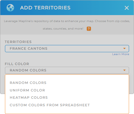
Make canton boundaries come alive when you apply territory color styles . Colors provide clarity and specificity of ideas when doing competitive analysis.
For example, which cantons are primarily being served by the competitors? Which cantons haven’t been served at all? And which cantons are served by all competing services? You can color-code them to visualize geographic segmentation.
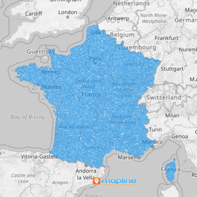
Click OK and your map of France cantons is ready to view!

GET NEW TERRITORY INSIGHTS
Beat the competition when you have these capabilities applied to your map:
- Leverage your existing dataset with Mapline data to analyze data across multiple rows
- Access key information behind your map visualizations via folder reports
- Ensure cost-effective delivery outcomes with advanced routing
With these capabilities, start roasting your competitors!


