
Extract Valuable Insights When Mapping Iceland Municipalities
Identify Data Connection in Municipality-Level Mapping
When making decisions, successful companies, firms, and organizations resort to mapping Iceland municipalities. Through the data visualization produced by a data-driven map, companies are able to see their customers across their business. They learn the customers’ buying power. An Excel data of locations may be too cumbersome to look at. But when it is added on a territory map, data will start making sense. You may see each location as a tiny dot. Visualizing them on a map helps connect the dots and produce valuable insights. Location nformation can be used in sales, marketing, and customer connection.
To make mapping experience up to the mark, Mapline makes it easy for users to add territory boundaries. Users can even customize the territory boundaries to drive further data analysis. There is so much more that you can do with territory mapping! Territory heat mapping, management, or territory analysis will be at your fingertips.
Connect with Customers with a Map of Iceland Municipalities
Drive customer connection by mapping your data with territory boundaries! Follow these simple steps:
- Create a Mapline account and login.
- Click the orange “Add New Items” button.
- Select “New Map” on the drop down arrow.
- Give your map a name and click “OK.”
- Click the “Add” button from the left sidebar.
- Select the “Territories” option.
- Click “From Mapline’s Repository.”
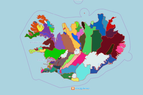
- From the “Territories” select “Iceland Municipalities.” You can also enter that on the search bar.
- Select how you want your boundaries to be colored in “Fill Color” (Random Colors, Uniform Color, Dynamic heat map colors, or Custom colors from spreadsheet).
- Click “OK.”
Use the right mapping tools to drive customer-centric decisions. Sign up now and learn how mapping technology can help grow your business.