
Incorporate Locations into High-Level Decision Making When Mapping Municipalities of Montenegro
Use Data When Mapping Municipalities of Montenegro for Accurate Understanding
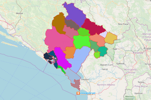
Government offices are mapping municipalities of Montenegro for a lot of reasons. To understand the country better, Montenegro is situated in the southeast part of Europe. It has 23 municipalities. 21 of these municipalities are district-level. 2 municipalities are urban-level. There are limitless reasons why municipality-level mapping is used by local authorities. A primary reason is that it is a basic way to integrate diverse data. In addition, it derives better understanding of the population. Accordingly, the map helps in public engagement into different programs.
The municipal-level mapping provides powerful insights on critical issues. As a result, the visualization is the basis for analysis used to create policies.
A Speedy Way to Plot Montenegro Municipalities
Start crafting solutions and communicate insights by building a map in 10 easy steps:
- Create a Mapline account and login.
- Click the orange “Add New Items” button.
- Select “New Map” on the drop down arrow.
- Give your map a name and click “OK.”
- Click the “Add” button from the left sidebar.
- Select the “Territories” option.
- Click “From Mapline’s Repository.”
- From the “Territories” select “Montenegro Municipalities.” You can also enter that on the search bar.
- Select how you want your boundaries to be colored in “Fill Color” (Random Colors, Uniform Color, Dynamic heat map colors, or Custom colors from spreadsheet).
- Click “OK.”
Finally, mapping in municipal level truly provides valuable insights! It helps authorities make the necessary responsiveness. Sign up now and learn more on how to create a territory map. Be confident in timely monitoring for added public security.