
Norway Municipality Map – A Valuable Monitoring Tool Municipality
Municipality-Level Analysis for Operational Efficiency
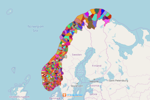
A Norway municipality map is an insurmountable help for local government units. It directs them to the right actions on how to shoulder their responsibilities more efficiently. Each municipality has its own local government unit. Some of its responsibilities include economic development, health services, primary education, and social services. Norway is a Nordic country located in Europe. In 2020, the country was divided into 356 municipalities from previously 422 municipality divisions. A municipality map is a data analytic tool that helps the local government agencies develop strategic plans.
During the distribution of health care assistance, one mapping tool that can be used is the distance calculator. In times of crises, time is very valuable. Hence, this tool helps to analyze distances between all the locations in your Excel spreadsheet. It significantly helps in minimizing travel and shipping time. In addition, the map shows the best routes for health care assistance and service distributions.
Managing Municipalities with Efficiency Through Mapping
Create a municipality map in less than a minute! Once generated, apply the distance calculation tool and begin your distance analysis:
- Create a Mapline account and login.
- Click the orange “Add New Items” button.
- Select “New Map” on the drop down arrow.
- Give your map a name and click “OK.”
- Click the “Add” button from the left sidebar.
- Select the “Territories” option.
- Click “From Mapline’s Repository.”
- From the “Territories” select “Norway Municipalities.” You can also enter that on the search bar.
- Select how you want your boundaries to be colored in “Fill Color” (Random Colors, Uniform Color, Dynamic heat map colors, or Custom colors from spreadsheet).
- Click “OK.”
Sign up now to learn more on how you can optimize your map to efficiently manage municipalities.