
Use Portugal Intermunicipal Community Map For More Detailed Data Analyses
A Map of Intermunicipal Communities – More Than Just an Attractive Visual
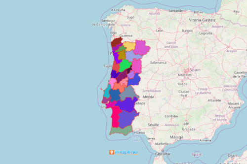
A growing number of organizations in the business sector are using a Portugal intermunicipal community map. Portugal is a country located in Europe. The country has a special territory boundary called “Intermunicipal Communities.” This boundary was created in 2013 to replace the urban communities. An intermunicipal community-level map is what the companies are looking for a more focused analysis of their business processes. An Excel map coupled with an overlay of this territory boundary provides a powerful visualization to understand customer data coverage. Moreover, it serves as a guide for territory distribution.
To enhance data visualization, there are mapping tools that can be used. One of them is the radius map. This is useful especially when assigning sales territories. Once territory assignments are identified, sales teams can draw personal routes to maximize the time and productivity. Thus, they avoid excessive travels, too much expenses, and miscommunication.
A Speedy Map Creation For a Better Visualization
Creating a map of intermunicipal communities takes only a few seconds. Once generated, you can customize your maps even more for better visuals. A map with attractive visuals invites more creative ideas that can contribute to drafting business plans.
- Create a Mapline account and login.
- Click the orange “Add New Items” button.
- Select “New Map” on the drop down arrow.
- Give your map a name and click “OK.”
- Click the “Add” button from the left sidebar.
- Select the “Territories” option.
- Click “From Mapline’s Repository.”
- From the “Territories” select “Portugal Intermunicipal Communities.” You can also enter that on the search bar.
- Select how you want your boundaries to be colored in “Fill Color” (Random Colors, Uniform Color, Dynamic heat map colors, or Custom colors from spreadsheet).
- Click “OK.”
Sign up now and enjoy the first hand experience of using powerful mapping tools that lets you understand how your organization is performing and where it stands when it comes to achieving business goals.