SWEDEN PROVINCES
- Territory Guide
- SWEDEN PROVINCES
Sure, you want your map of Sweden provinces to be visually presentable. But you’re in Mapline not only for that. You want your map to be functional too. The truth is, here in Mapline, we want to make sure that you have the best mapping experience as you explore all your options while enjoying your analysis.
Fasten your seatbelt and be prepared to explore the impact of territory on your analysis.
WHAT ARE SWEDEN PROVINCES?
There are 25 provinces in Sweden. When all of these are plotted on a map, you get to learn a lot about the provincial boundaries. It also opens a gateway for you to streamline your business operations to seek more opportunities and put you on the path toward sales growth.
ADD SWEDEN PROVINCES TO MAP
Suppose you own a business and want to think of ways to expand. What’s the first thing you do? It’s only logical to understand the dynamics of each province. A clear understanding of the territory layout aids in tapping new opportunities to reach out to different communities and local markets.
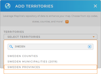
From Mapline’s Repository, you can easily add Sweden provinces . Type SWEDEN in the search bar and choose SWEDEN PROVINCES.


Pro Tip: The 25 provinces of Sweden do not perform as administrative divisions. However, they are still popularly used for deeper analysis aside from the fact that this level of boundaries are significantly used for historical legacies and cultural identification.
CHOOSE PROVINCIAL COLORS
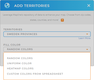
Now, before you hit OK, the last option for you is to choose from the fill colors option. This is where you’re going to choose the right color style for your territories.
As you bring colors to your map while doing territory analysis, you’ll be directed straight to the insights that you’re looking for! The variables that are needed for informed decision making. That’s the power of color styles! You’ll get an instant pass on knowing where your customers are, the business risks, or dealing with the growing competition.
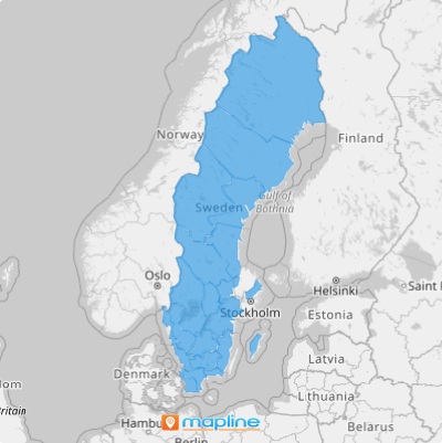
Once you have selected the color style that fits your analysis, your Sweden provinces map is ready to go.

GET NEW TERRITORY INSIGHTS
Want to know what else you can do with your Sweden province map? Check out other features:
- Find out how many competitors exist within your store’s province when you configure Mapline data
- Get an automatic calculation of drivers’ driving distance, hours spent driving, and everything in between through advanced routing
- Highlight coverage areas to spot the factors affecting your business
Don’t let anyone stop you from starting your provincial-level analysis now!


