FINLAND MUNICIPALITIES
- Territory Guide
- FINLAND MUNICIPALITIES
Unlock deeper business insights by adding Finland’s municipalities to your Mapline map. A municipal-level view of Finland allows brands to optimize operations, manage resources, and strategize with precision across local markets. For companies involved in sales, dispatch, or service maintenance, mapping municipalities helps track performance, plan efficient routes, and understand customer needs at a granular level. By visualizing your market across Finland’s municipalities, your team can make data-driven decisions that enhance local impact and improve efficiency.
Let’s explore how mapping Finland municipalities can support your business goals!
WHAT ARE FINLAND MUNICIPALITIES?
Finland is divided into over 300 municipalities, each serving as a local administrative unit responsible for governance, public services, and community development. Each municipality has its own characteristics, making municipal boundaries valuable for businesses aiming to manage resources, optimize logistics, or target specific markets. For brands in logistics, sales, and operations, mapping Finland’s municipalities allows for efficient resource allocation, customer segmentation, and targeted marketing efforts. This municipal focus supports a strategic, data-driven approach to meet local demands and drive growth.
Mapping Finland’s municipalities enables businesses to make location-specific decisions that improve operational effectiveness and customer satisfaction.
ADD FINLAND MUNICIPALITIES
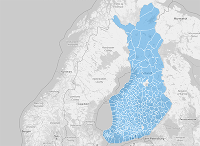
Adding Finland’s municipalities to your Mapline map provides a structured view of your business activities across the country, making it easier to plan routes, track regional performance, and analyze customer engagement.
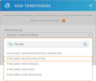
To add this territory, add a new territory from Mapline’s repository, type FINLAND in the search bar, and select FINLAND MUNICIPALITIES from the dropdown. This gives you a comprehensive foundation to dive into local insights.


Pro Tip: Mapline’s global territory repository offers extensive administrative boundaries for Finland, including Finland Administrative Agencies, Finland Provinces, Finland Regions, Finland Subregions, and municipalities, that support country mapping, ideal for brands expanding into new regions. Explore the repository to find territories that align with your goals and build a powerful, insight-rich map.
CHOOSE YOUR COLORS
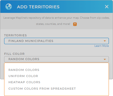
Color-coding Finland’s municipalities provides instant visual clarity, helping you assess performance, customer density, or high-demand areas at a glance. By applying color styles, you’ll make it easier to interpret data, prioritize resources, and make faster, data-backed decisions.
To apply color styling, select your preferred color styling to enhance your map’s utility and bring data insights to the forefront.

GET NEW TERRITORY INSIGHTS
Maximize the value of your Finland municipality map with Mapline’s advanced capabilities:
- Analyze competitors and market footprints to assess market share and refine your strategies
- Create heat maps to visualize data density and spot areas of high demand or customer activity
- Use coverage areas to evaluate service reach and plan expansions effectively


