GHANA DISTRICT MAP
- Territory Guide
- GHANA DISTRICT MAP
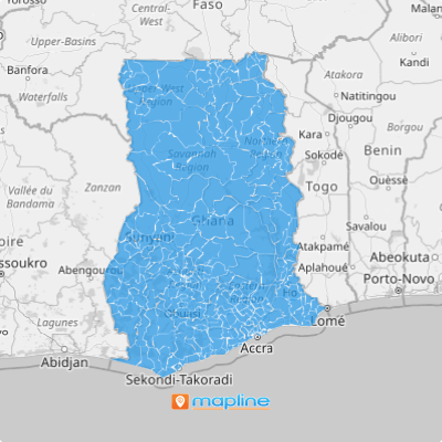
Add a Ghana district map in Mapline and level up your analytics! This is a great way to learn more about your customer base, create targeted campaigns, or expand your market presence in Ghana.
Revolutionize the way you understand and optimize your business strategies! Let’s dive in and explore how to create this type of territory map.
WHAT ARE GHANA DISTRICTS?
In Ghana, districts serve as the backbone of administrative divisions, offering a granular view of the country’s diverse regions. With 261 districts to explore, each with its unique characteristics and opportunities, the possibilities for market analysis and expansion are endless.
Imagine you’re a sales team looking to penetrate the Ghanaian market. By incorporating Ghana Districts into your Mapline map, you can conduct hyper-local market research, identify emerging trends, and target specific districts with tailored sales initiatives. For instance, you could leverage district-level demographic data to identify areas with high population density and purchasing power, allowing you to focus your sales efforts where they’re most likely to yield results.
Isn’t that incredible?
ADD GHANA DISTRICTS TO MAP
Overlaying a district territory on your map can boost your sales territory analysis and management, drive informed decisions, identify trends and patterns, and much more.
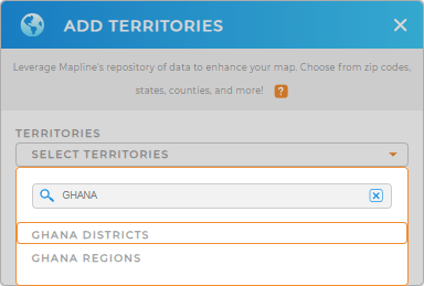
It only takes a few clicks to add Ghana districts to a Mapline map. Just add a new territory from Mapline’s repository, type GHANA into the search bar, and click GHANA DISTRICTS.
Wham, Bam, Done!


Pro Tip: Explore the versatility of Mapline’s territory repository by adding not just districts but also Ghana regions to your map. By incorporating various types of territories, you can unlock a diverse range of insights tailored to your specific business needs.
CHOOSE DISTRICT COLORS
Speed up your territory analysis with color-coded territories!
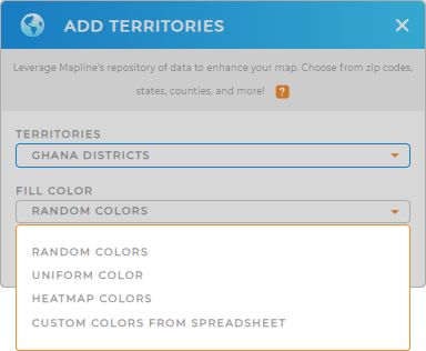
Whether you choose a heat map, custom color, uniform, or random colors, you’ll enhance the functionality and visual impact of your district map. This is a great way to quickly pinpoint insights and discover new solutions for your brand.
Just select your preferred color style and click OK. Easy peasy!

GET NEW TERRITORY INSIGHTS
Let’s explore how to capitalize on your new map of Ghana districts. Here are some common ways Mapline users get the most out of their territory maps:
- See a summary of your territories in seconds
- Share your map to your team in just one click
- Learn more about your customer base by filtering your data
- Quickly create the most optimized routes known to man within each district boundary
Woah, that’s incredibly useful!


