GREECE REGIONAL UNITS
- Territory Guide
- GREECE REGIONAL UNITS
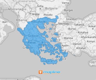
Got a minute? That’s all you need to add Greece regional units to your map! With Mapline, you can streamline the process of adding territories, saving valuable time so you can focus on what truly matters—analyzing your data. Picture this: a bird’s-eye view of regional dynamics that empowers you to fine-tune your strategies for specific areas. By visualizing your data within region boundaries, you’ll uncover countless insights to drive smarter decisions and boost your business operations.
Ready to get started? Let’s map it out together!
WHAT ARE GREECE REGIONAL UNITS?
Greece, a beautiful country in Southeast Europe, is situated at the southern tip of the Balkan Peninsula. Its administrative structure is organized into 13 regions, which are further subdivided into 74 regional units—the country’s third-level administrative divisions. These regional units serve as the building blocks of local governance, each falling under one of the larger regions. Each regional unit is led by a vice-regional governor, who is appointed from the same political block as the regional governor. These units are further broken down into municipalities, ensuring that governance is both localized and efficient, with each level working in harmony to serve Greece’s diverse communities.
As you dive deeper into this geographic framework, you’ll uncover how these areas can elevate your strategic planning and decision-making. By harnessing the unique characteristics of each province, you can fine-tune your marketing and operations to meet the specific needs of your market, giving your brand a strong edge in a competitive landscape.
ADD GREECE REGIONAL UNITS
Whether your goal is to strengthen your brand presence, elevate your operations, or deepen market penetration, you’ll never go wrong in leveraging a map of Greece regional units into your analytics. This is your secret weapon for making smarter, data-driven decisions.
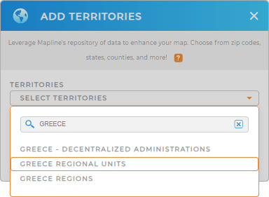
First, add a new territory from Mapline’s repository. Type GREECE in the search bar and choose GREECE REGIONAL UNITS from the selections to add the correct territory to your map.
That’s how simple Step 1 is. Now, let’s quickly move on to Step 2.


Pro Tip: To help boost your analytics, Mapline’s extensive repository of territory boundaries lets you add different administrative boundaries present in Greece including Greece decentralized administrations, Greece regions, and regional units.
CHOOSE REGIONAL UNIT COLORS
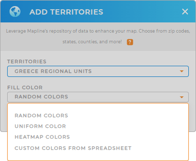
Step 2 is applying fill colors to your territory. Colors help to differentiate between regional units and add significant value to your map, transforming it into a powerful analytical tool. Embrace the power of a color-coded map and you can quickly spot trends, identify the level of performance in each regional unit, and understand demographic differences. How awesome is that!
Apply the color styling option that best suit your level of analysis. Explore how colors elevate your analysis.

GET NEW TERRITORY INSIGHTS
Here are some other ways that you can leverage your map of regional units:
- Turbocharge your calculations with demographic data
- Visualize customer density at a glance
- Create precise sales territories in just a few clicks


