GUINEA REGIONS
- Territory Guide
- GUINEA REGIONS
Create and leverage a map of Guinea’s regions to elevate your analysis and gain game-changing insights. By mapping out your customers across Guinea’s diverse landscapes, you unlock a powerful advantage, enabling you to fine-tune your marketing strategies with laser precision and optimize your operations to run seamlessly. This map goes beyond visuals—it’s a tool for action. It turns raw information into powerful insights, giving your business the edge it needs to soar to new heights.
Ready to supercharge your strategy and soar? This map is your key!
WHAT ARE GUINEA REGIONS?
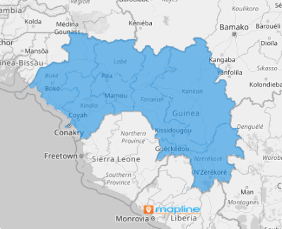
Guinea, divided into eight regions, is an emerging player in different industries, making region-level mapping essential for think tanks and brands focused on crafting more efficient business strategies. Using a region map of Guinea for location analytics is a powerful way to gain deeper insights into the country’s economic and environmental landscape.
Map Guinea regions today to visually explore how geographical factors impact your business! With the power of location analytics, this region map provides a comprehensive view that can lead to more strategic, informed approaches for tapping into the country’s business potential.
ADD GUINEA REGIONS
Let your map of Guinea regions be your compass for success, guiding you toward growth in every corner of the market. Tap into critical insights that fuel informed decision-making, driving performance and uncovering new opportunities in this dynamic market.
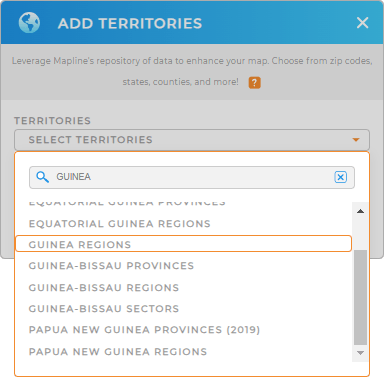
To get a better picture of your business operations within region boundaries, add a new territory from Mapline’s repository. Then type GUINEA into the search bar to click on GUINEA REGIONS and add to your map.
The next step will enhance your analysis to drive more insights from data-driven decision-making.


Pro Tip: By adding different regional boundaries from Mapline’s extensive list of territory boundaries, you can deepen your understanding of the factors that influence your business on a global scale. Go ahead and try adding territories to your maps in seconds!
CHOOSE REGION COLORS
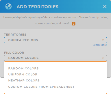
Now, instantly uncover insights about your target market when you apply territory colors. Colors are an invaluable tool in identifying trends and patterns across regions at just a glance. Imagine the time you spent in analysis is cut significantly because your color-coded map gives you the clarity to craft smarter strategies, streamline planning, and optimize delivery routes!
Pick a color styling option that you think matches your level of analysis. Once you have configured your settings, click OK.
Wow, that’s mind-blowing, to say the least!

GET NEW TERRITORY INSIGHTS
Do you know that you can quicken your data analysis of your region territory map by applying these added capabilities? Try them now!
- Seamlessly generate advanced route optimization
- Get instant access to your data within a territory
- Sort your data like a pro to easily capture insights


