HUNGARY COUNTIES
- Territory Guide
- HUNGARY COUNTIES
Map your insights across Hungary counties and gain a crystal-clear view of the competitive landscape. Instantly spot market trends, identify key opportunities, and fine-tune your strategies with confidence. By seamlessly visualizing your information within county boundaries, you’ll uncover hidden patterns and connections that drive smarter decisions. Stay ahead of the competition and watch your business thrive—one mapped insight at a time!
Transform your sales figures into a blueprint for your next strategic move once you add these administrative boundaries to your map. Ready when you are, let’s start now!
WHAT ARE HUNGARY COUNTIES?
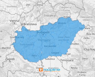
Hungary is administratively divided into 19 counties, with Budapest as its capital. Each county offers unique character and charm, contributing to the country’s rich cultural and geographical diversity. Hungary may be small in size, but it’s a country abundant in diverse, stunning landscapes and rich natural resources. By integrating dynamic visualizations in a county territory map, you can unlock deeper insights and make real-time adjustments. Imagine having the power to uncover hidden trends across regions!
With a county-level analysis, you can sculpt strategies to streamline your operations, optimize resource allocation, and improve your sales and marketing strategies, positioning your business for sustained growth and success.
ADD HUNGARY COUNTIES
Adding Hungary counties to your map significantly enhances your ability visualize insights, transforming your strategies into exceptionally effective approaches. This powerful visualization empowers you to capture specific trends and insights within each county, giving you a full understanding of market dynamics.
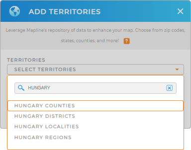
Embrace this powerful mapping capability as you start to add a new territory from Mapline’s repository. In the search bar, type HUNGARY to trim down the selections and choose to add HUNGARY COUNTIES to your map.
One last step to enable your county-level map with the clarity needed to make data-driven decisions.


Pro Tip: Mapline’s territory repository offers an extensive list of worldwide territory boundaries including Hungary counties, Hungary districts, Hungary regions, and Hungary localities. Analyze regional data broadly as you leverage adding these boundaries to your map, gaining fresh insights for continuous business growth.
CHOOSE COUNTY COLORS
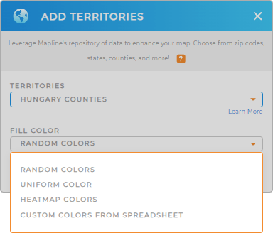
The last step is to boost your territory map by filling it with colors. Applying colors to county boundaries is crucial for swift data visualization. This vibrant process increases the functionality of your map big time!
Choose from Mapline’s color styles – heat map, custom colors, uniform color, or random colors – to transform your county map into an effective tool that brings out better decision-making and drives effective strategies.

GET NEW TERRITORY INSIGHTS
Unlock deeper insights when you apply these advanced analytical capabilities:
- Craft cost-efficient delivery plans and boost your bottom line by 30%
- Quickly reshape your territories to balance your workload
- Streamline your delivery operation by filtering the delivery date schedules


