INDIA STATES
- Territory Guide
- INDIA STATES
Unlock the potential of your business with an India states map in Mapline. Dive deeper into how location insights empower local governments and organizations to make bold, informed decisions that uplift communities. It’s about seizing opportunities, tackling challenges head-on, and building a stronger, more resilient society.
For instance, imagine you’re a logistics manager seeking to optimize your delivery routes across India’s diverse states. Incorporating India states into your map allows you to analyze regional demand patterns, streamline logistics operations, and enhance delivery efficiency.
WHAT ARE INDIA STATES?
India states are distinct geographical regions within the country of India. There are 28 states in India, each with its own diverse culture, language, festivals, resources, and heritage.
Many businesses greatly benefit from a territory map of India’s states. For example, a logistics manager may want to leverage this type of map to inform product availability, optimize delivery routes, or minimize transportation costs.
ADD INDIA STATES TO MAP
Ready to explore how cutting-edge state mapping can supercharge your business planning in India and beyond? Let’s turn insights into impact—and shape a brighter future together!
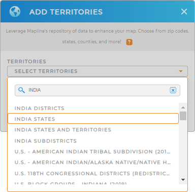
Adding India states to your map is fast and easy! First, add a new territory from Mapline’s repository. Type INDIA into the search bar and select INDIA STATES from the drop-down options.
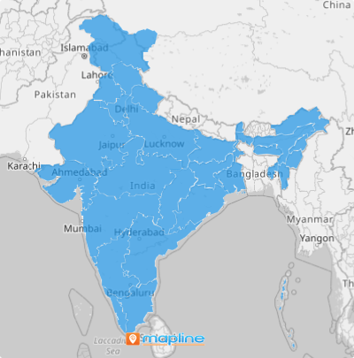
This will automatically import the state boundaries onto your map.
That’s Step 1! Now let’s check out Step 2.

CHOOSE STATE COLORS
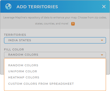
Add vibrancy and clarity to your map by incorporating colors into your India States territories.
Color-coded territories not only enhance visual appeal but can also aid in analyzing various aspects such as audience demographics, ad targeting, and determining local service offerings.
Just select the color style that best suits your territory analysis, and in one click, your map comes to life with vivid insights.

GET NEW TERRITORY INSIGHTS
Take your analysis to the next level with Mapline’s advanced features tailored for India State mapping.
- Add information to your map through labels to guide your audience
- Learn the ins and outs on each territory once you access the folder report
- Assign multiple tiers to your segmented data to quickly access specific information


