IRELAND PROVINCES
- Territory Guide
- IRELAND PROVINCES
For brands that operate in Ireland, it’s necessary to add Ireland provinces to their map of data. A province territory map leads to better decision-making for strategic planning. What about you? Is this your first time to try territory management? Perhaps you’ve been thinking about it for some time now but don’t know how to start. You’re in luck! Because here in Mapline, the first step is the easiest like adding Ireland provinces to your map.
Now’s the right time to get your hands on territory planning and management. Get it right the first time with Mapline! Explore the many benefits of adding the province boundaries to your map especially when you realize that it’ll only take a minute (or less) to overlay boundaries to your map. But first, let’s take a closer look at the Ireland provinces.
WHAT ARE IRELAND PROVINCES?
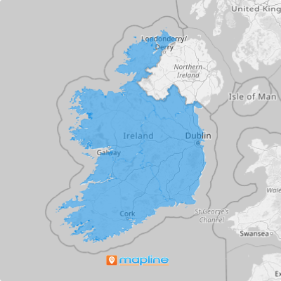
Ireland is divided into four provinces: Connacht, Leinster, Munster and Ulster. The provinces of Ireland no longer serve administrative or political purposes but function as historical and cultural entities. However, many brands still leverage this province map to assign sales territories. A map showing these provinces serves as a general framework for the overall territories assigned to your team. Add your data quickly and as you analyze it alongside the province boundaries, you can easily define your market, foresee risks, and identify growth opportunities.
Be blown away by all the insights you’ll get the moment you analyze your data on your territory map!
ADD IRELAND PROVINCES TO MAP
To gain success in territory planning and management, the first step is to add a new territory from Mapline’s repository. The building blocks of a successful territory planning is being concise, feasible, and organized. Thanks to Mapline’s Repository, you’re miles ahead of achieving the best territory plans ever!
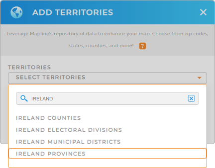
Simply type IRELAND in the search bar then choose IRELAND PROVINCES.
Now let’s get going to the next step.


Pro Tip: You can access different territory boundaries for Ireland like Ireland counties, provinces, Ireland electoral divisions, and Ireland municipal districts. They’re all accessible from Mapline’s Repository. Go ahead and create and manage territories to streamline your sales and marketing analysis.
CHOOSE PROVINCIAL COLORS
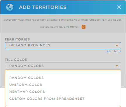
Now that you have the right territory, how do you execute your sales territory planning successfully with your customers always in mind? The answer is to apply territory color styles.
If you have a chunk full of customer data, use heat map colors to excavate demographic trends. Or you can play around and customize your territory colors in a spreadsheet.
Whatever option you choose, the right color style helps you make informed decisions.
Once you have configured your color preference, click OK and you’ve just created a map of Ireland provinces.

GET NEW TERRITORY INSIGHTS
Pack your map with these useful capabilities now to extract the best location information for your decision-making:
- Create optimized routes from the data within your territory
- Target marketing campaigns when you segment your customers
- Merge data or run calculations when you leverage Mapline data in seconds


