ITALY PROVINCES
- Territory Guide
- ITALY PROVINCES
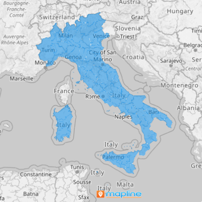
Create a map of Italy provinces and keep up with the constantly growing trends in the business industry! Explore the impact on your location analytics and marketing strategies as you dive deeper and know better about the landscapes of each province. With this detailed view, you’ll gain valuable insights into each province’s unique dynamics, enhancing your location analytics and refining your marketing strategies. Province-level analysis enables you to tailor initiatives to meet local needs, optimize resources, and uncover insights that might otherwise remain hidden. The clarity of this detailed mapping approach empowers you to make data-driven decisions that fuel growth and amplify operational effectiveness.
Embrace this powerful tool to develop strategies that resonate deeply with your target markets across Italy!
WHAT ARE ITALY PROVINCES?
Italy, a captivating country in Southern and Western Europe, stretches along a peninsula into the Mediterranean Sea, framed by the majestic Alps to the north. The country’s administrative framework is divided into several levels, with provinces serving as the second-tier divisions, positioned between municipalities and regions. Today, Italy is organized into 107 of these entities, including 80 standard provinces, 2 autonomous provinces, 4 regional decentralization entities, 6 free municipal consortia, and 14 metropolitan cities, as well as the Aosta Valley region, which independently fulfills the functions of a province. This structure creates a blend of local autonomy and national cohesion, supporting Italy’s diverse regions.
Suppose you’re running a logistics company and want to optimize delivery routes within each province. A province-level mapping is an awesome way to speed up your analysis into drawing routes that reduce delivery times. Think about that!
ADD ITALY PROVINCES
Unlock the potential of a province-level map of Italy to stay ahead in the fast-evolving business landscape! Gain a comprehensive understanding of how your data connects to province boundaries. The insights that this map provides can elevate your decision-making, offering clear insights into regional trends and customer needs.
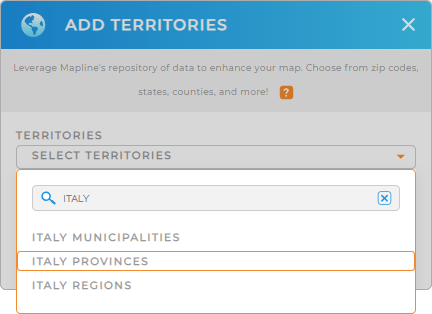
To begin with, simply add a new territory from Mapline’s repository. Type ITALY into the search bar to cut down the selections. Then choose ITALY PROVINCES.
Easy peasy!


Pro Tip: Mapline’s Repository includes Italy provinces, Italy regions, and Italy municipalities. Go ahead and add any of those to your map to start your territory management plans.
CHOOSE PROVINCE COLORS
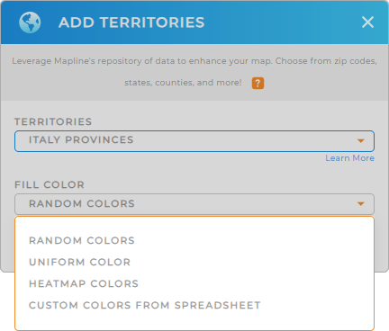
To answer key questions like what are the market trends, where can you find new customers, or what stores are at high risk, one significant part of adding territories is adding colors to them.
Highlight and categorize provincial boundaries. Get at-a-glance insights into key factors influencing your business by choosing the right color styles that make the most sense for your business. That’s strategic decision-making at a higher level!
When you’re done configuring your settings, click OK to complete the process of creating a map of Italy provinces.

GET NEW TERRITORY INSIGHTS
Make your map of Italy provinces more functional when you add these capabilities:
- Identify where local markets are shifting by heat mapping
- Reduce your delivery costs significantly with optimized routes
- Take your analysis up a notch by adding your dataset to your map.


