LIBERIA COUNTIES
- Territory Guide
- LIBERIA COUNTIES
Map out Liberia counties and stay on top of your daily operations like never before! If you’re a business strategist steering your team toward impactful marketing wins, mapping out county boundaries is a total game-changer. Visualizing trends within county boundaries is a total game-changer. Unlock hidden connections that fuel better customer engagement and drive operational success by leveraging a county map of Liberia. Transform your analytics to streamline your business operations, optimize logistics, and align your marketing strategies for maximum impact.
Get ready to elevate your business and connect with your customers on a whole new level by leveraging a map of Liberia counties to your analytics.
WHAT ARE LIBERIA COUNTIES?
Liberia, known as the “Land of the Free,” is a coastal country in West Africa, rich in opportunity and growth potential. Divided into 15 counties and 90 districts, each region offers unique business landscapes. For many successful brands, mapping Liberia’s county boundaries isn’t just a logistical tool—it’s a strategic move to identify areas ripe for development and expansion.
By focusing on these divisions, businesses can uncover untapped markets and explore opportunities that lead to sustainable growth and impactful customer connections.
ADD LIBERIA COUNTIES
In a few seconds, learn to add Liberia counties to your map to start crafting marketing strategies for your customers. By understanding the geographic nuances of each district, you can tailor your strategies to meet the needs of your audience, creating deeper connections and driving meaningful engagement.
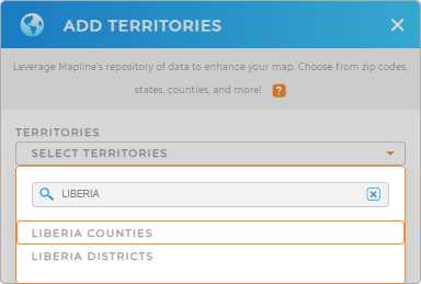
Add a new territory from Mapline’s repositoryand you’ll be done in no time! Type LIBERIA in the search bar and select LIBERIA COUNTIES.
Now that you’ve added the right territory, there’s only one step remaining before your map is complete.


Pro Tip: Mapline’s worldwide territory repository is your ultimate gateway for mapping boundaries across the globe. The comprehensive list of territory boundaries, including Liberia districts and counties, allows you to dive deep into regional analysis, empowering your business to make informed decisions to achieve greater growth and success.
CHOOSE COUNTY COLORS
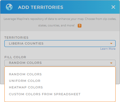
The last important step is to color-code your county map. Add colors to highlight key regions and unlock powerful location-based insights that deepen your understanding of the market, This not only sharpens your decision-making but also paves the way for a more sustainable, growth-oriented business. Each color tells a story, helping you identify opportunities, optimize resources, and strategically position your brand where it matters most.
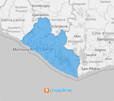
How do you do that? Just add the best color styles that allow you to gain the deepest insights from your data. Lastly, click OK to wrap up your map of Liberia counties

GET NEW TERRITORY INSIGHTS
Maximize the use of your map of Liberia counties when you leverage these capabilities:
- Analyze coverage areas to improve campaigns and distribution
- adds precise details to your analytics by generating center points from your map pins
- Customize the behavior and appearance of your pop-out bubbles


