LUXEMBOURG COMMUNES
- Territory Guide
- LUXEMBOURG COMMUNES
Harness the power of a map of Luxembourg communes for rapid territory analysis. Creating a territory map in just 60 seconds or less offers an unmatched level of simplicity and speed. This approach allows you to gain deep insights quickly, making your decision-making process faster and more effective. By streamlining your approach to business strategizing, you can focus on what truly matters—providing exceptional value to your customers.
Don’t wait—take action now. Get more on territory mapping to improve your business operations and drive your business forward!
WHAT ARE LUXEMBOURG COMMUNES?
Luxembourg, officially known as the Grand Duchy of Luxembourg, is a small landlocked country in Western Europe and the seventh smallest in Europe. Its 12 cantons are subdivided into 100 communes, the lowest administrative units. Communes are frequently restructured based on demographic shifts. They are responsible for providing local government services.
When these administrative regions are added to your map, you can visually pinpoint the connections between store locations, competitors, and customers. This is your pathway to tailor-fit solutions that address your customers’ needs. This approach helps you discover innovative strategies that may have been hiding in plain sight.
ADD LUXEMBOURG COMMUNES
Adding Luxembourg communes to your map is a critical step in analyzing your data to identify areas with high customer service demand. By strategically analyzing these regions, you can deploy resources where they are needed most, ensuring that customer needs are met swiftly and efficiently. This proactive approach not only enhances customer satisfaction but also builds long-term loyalty and trust.
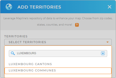
Ready to create your Luxembourg commune map? Start by adding a new territory from Mapline’s repository. Type LUXEMBOURG in the search bar and choose LUXEMBOURG COMMUNES.


Pro Tip: Mapline’s territory repository has a comprehensive list of boundaries including Luxembourg cantons and communes. Level up your analysis as you add these territories to explore more geographic insights that greatly affect your business.
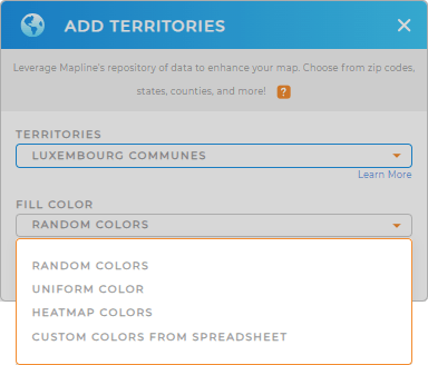
CHOOSE COMMUNE COLORS
Take your map analysis to the next level with color-coding. By filling your territories with static or dynamic colors, you gain powerful insights that are easy to interpret and act on.
Applying the right color styling to your map sparks new ideas, allowing you to quickly identify under-performing regions and direct your focus and resources where they’ll make the most impact.
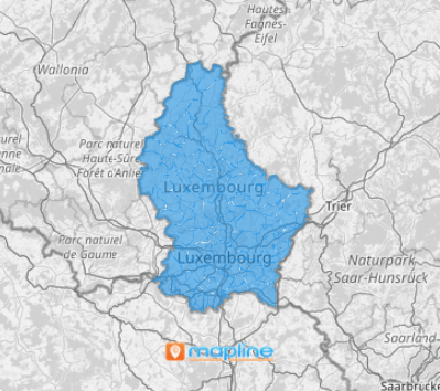
Lastly, click OK. Now, your map of Luxembourg communes is in your hands ready to be analyzed.

GET NEW TERRITORY INSIGHTS
To maximize the use of your commune map, check out these powerful capabilities to extract more valuable insights:
- Gain deeper insights into your sales performance and operational efficiency as you segment your market
- Calculate driving distance to estimate travel times and fuel costs
- Visualize data density around your pins with a radius-based heat map


