FEDERATED STATES OF MICRONESIA (FSM) MUNICIPALITIES
- Territory Guide
- FEDERATED STATES OF MICRONESIA MUNICIPALITIES
Gain powerful insights by adding Micronesia municipalities to your Mapline map. Mapping municipalities in Micronesia provides a strategic view for brands looking to streamline operations, optimize logistics, and target local markets. This municipal-level analysis is especially useful for companies managing distribution, service delivery, or regional marketing efforts. With a clear visualization of your data aligned with local boundaries, you can uncover trends, improve resource allocation, and make decisions that drive impactful results.
Let’s explore how you can leverage Micronesia’s municipality boundaries to uncover valuable insights for your business!
WHAT ARE FEDERATED STATES OF MICRONESIA (FSM) MUNICIPALITIES MUNICIPALITIES?
The Federated States of Micronesia (FSM), an island nation in the Pacific, is divided into municipalities that serve as administrative regions for governance, resources, and community services. Each municipality represents a unique area with specific needs and demographic traits, making it essential for brands to understand these divisions. For businesses in logistics, sales, or operations, mapping municipalities allows for precise targeting, efficient resource management, and improved customer reach. This municipal-level view ensures you can tailor your strategies to meet the needs of each region and enhance operational efficiency.
Mapping Micronesia’s municipalities enables brands to make location-driven decisions that align with local demands and drive growth.
ADD FSM MUNICIPALITIES
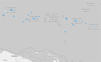
Adding Micronesia’s municipalities to your Mapline map allows you to visualize and analyze your operations with a region-specific approach, making it easy to monitor operations, track performance, and improve resource distribution.
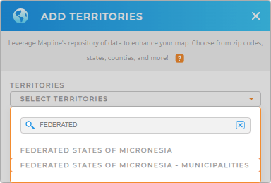
To add these territories, add a new territory from Mapline’s repository, type MICRONESIA in the search bar, and select MICRONESIA MUNICIPALITIES from the dropdown. This foundational setup gives you the insights needed to manage your operations with local precision.


Pro Tip: Mapline’s global territory repository includes a wide range of territory boundaries worldwide, enabling you to manage operations across different countries with ease. This capability is ideal for expanding brands or those seeking to understand new markets. Browse our global repository to add Federated States of Micronesia and its municipality boundaries that match your business goals and unlock new insights.
CHOOSE YOUR COLORS
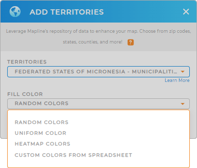
Applying color styles to your Micronesia municipality map makes analysis simple, helping you visually identify performance zones, customer clusters, and high-priority areas. By color-coding municipalities, you’ll quickly spot trends and make adjustments to your strategy with clarity.
To add color styles, select your preferred color styling to enhance your data visualization and focus on what matters most.

GET NEW TERRITORY INSIGHTS
Take your Micronesia municipality map further with Mapline’s powerful capabilities:
- Automate job assignments to optimize scheduling and dispatch across municipalities.
- Leverage Mapline Data to access key demographic information, providing insights into population trends and customer preferences.
- View folder reports to track performance metrics and see data by territory.


