Myanmar Townships
- Territory Guide
- Myanmar Townships
Add Myanmar townships to your map and revolutionize your strategic planning and decision-making processes! Incorporating these territorial boundaries into your maps gives you valuable insight into local trends, patterns, and preferences, empowering you to drive decision-making with rich data.
Whether you’re in sales, marketing, logistics, or operations, mapping Myanmar townships offers a holistic view of your target markets, enabling you to tailor your approach and seize new opportunities. Let’s dive in!
WHAT ARE MYNAMAR TOWNSHIPS?
Myanmar townships are the sub-divisions of the districts of Myanmar. There are 330 townships in Myanmar, each with their own unique characteristics and demographics.
Many brands look to a Myanmar township map to optimize sales and operations in the area. For example, a marketing team could leverage a township map to identify potential areas for market expansion or penetration. Or, logistics and operations teams could utilize a township map to optimize delivery routes and streamline operations across Myanmar. A map of Myanmar township boundaries facilitates informed decision-making and strategic planning–let’s dive into how to add these valuable boundaries to your map!
ADD TOWNSHIPS TO MAP
It only takes seconds to add Myanmar townships to your Mapline maps! This is a fantastic way to ensure effective, geo-intelligent business management.
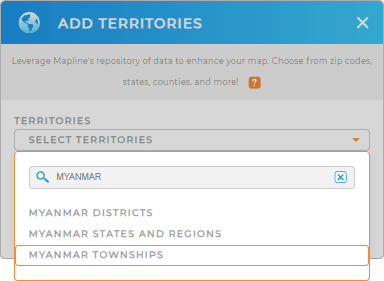
First, add a new territory from Mapline’s repository and type MYANMAR into the searchbar.
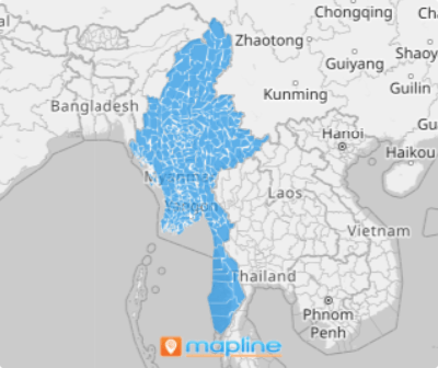
Select MYANMAR TOWNSHIPS and BOOM! You’ve got a detailed map of township boundaries–there’s just one more quick step before your map is ready to go.


Pro Tip: Mapline’s vast, worldwide repository offers many different territory boundaries for Myanmar. Choose from Myanmar districts, Myanmar states and regions, and townships, and tap into a variety of insights.
CHOOSE TOWNSHIP COLORS
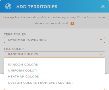
A territory map is nothing without custom colors! This makes it easier to identify patterns in your data and get the information you need in a glance!
Just choose your preferred type of color styling, then click OK.
Now, you’re ready to dive into analytics and discover new insights about your brand and operations! How incredible is that?

GET NEW TERRITORY INSIGHTS
It doesn’t stop there! Now, you have the power to make your data come to life. Try some of these powerful capabilities and watch your analytics transform:
- Hone in on key segments of your data to get the insights you need
- Leverage Mapline Data to calculate distances between locations, estimate drive times, and gather geographic insights about your territories
- Bring other Mapline territories into the mix and see how they align with Myanmar township boundaries


