NORTH AMERICA STATES
- Territory Guide
- NORTH AMERICA STATES
Turn a map of North America states into a pool of analytic learnings now! Once you overlay the state boundaries to your map, get ready to discover new ideas, patterns, trends, and insights for retail, sales, and territory management. Unlock the power of North American state boundaries on your map with Mapline! Add these boundaries to yoru map today to tap into a wealth of location-based analytics, revealing new patterns, trends, and ideas for sharper, more effective territory management.
Mapline’s North America state boundaries give you the edge you need to craft a winning sales territory strategy. Ready to dive in? We’ll walk you through some essential best practices for sales territory management, starting with how to add North American states to your map seamlessly. So let’s make this mapping and analytic experience the one that you’ll never forget.
WHAT ARE NORTH AMERICA STATES?
The northernmost countries in North America include:
- United States
- Bermuda
- Canada
- Greenland
- Pierre
- Miquelon
If your business stretches from one state to another, Mapline has the perfect territory for you – the North America States. This is the best territory boundaries to analyze if you want to create a winning sales territory plan. Let’s show you some basic best practices for sales territory management starting on how to easily add the North America states to your map.
ADD NORTH AMERICA STATES
Make smarter, data-driven decisions today with Mapline! Adding North American state boundaries to your map elevates your visualization, allowing you to grasp the full scope of your network and operations. Even better, the connections that emerge between your data and these state boundaries empower you to make informed, strategic decisions with confidence.
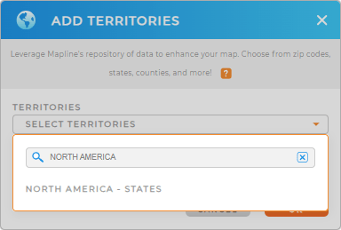
The first step is to add a new territory from Mapline’s repository. Use the search bar and type in NORTH AMERICA.
We’re down with the first step, let’s now move on to the last step.


Pro Tip: Whether you’re managing a global supply chain, tracking sales across North America states, or planning marketing campaigns across these areas, Mapline’s territory repository has got you covered. Territories from the individual countries in the North America states can also be accessed here.
CHOOSE STATE COLORS
Accelerate your territory analysis the moment you add colors to your state map. Color-coding each territory brings your data to life, making it easier to compare and contrast insights across regions. With color-coded territories, you can quickly pinpoint high-income areas, identify ways to minimize expenses, and map out the next strategic moves for your business expansion.
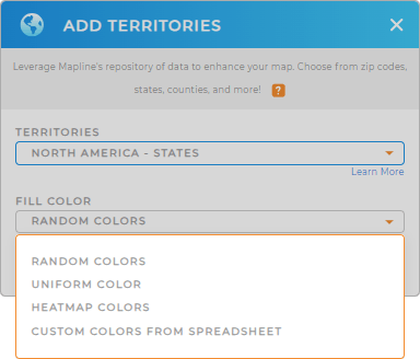
How do you achieve that? Start by selecting the color styles from the drop-down menu, then click OK.
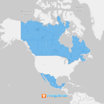
And that’s it! Now, explore more valuable options and insights as you analyze your data on your map of North America states.

GET NEW TERRITORY INSIGHTS
Get the best results from your state-level analysis when you apply these capabilities:
- Evaluate the performance of different services by creating segments
- Leverage your existing datasets to pull new columns into a datasets with Mapline dataset
- Assign a maximum number of routes per group with advanced routing


