MEXICO STATES
- Territory Guide
- MEXICO STATES
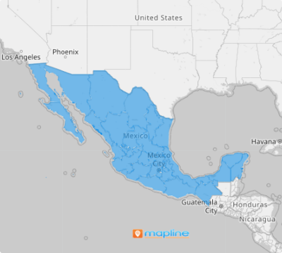
Great news! The 31 Mexico States can now be added to your map in just a few clicks! With this territory overlay, understand the risk factors of your stores, monitor your franchise business, or assess the buying patterns of your target market.
Ready to create your map of Mexico states? Get started now!
WHAT ARE MEXICO STATES?
The Federal Republic of Mexico 31 states and a Federal District, Mexico City, which serves as the country’s capital that also serves as a role of a state. Learn to analyze state-wide geographic factors affecting your business so you can seamlessly create plans that work for your team in terms of managing customers, sorting prospects, and improving sales productivity.
ADD MEXICO STATES TO MAP
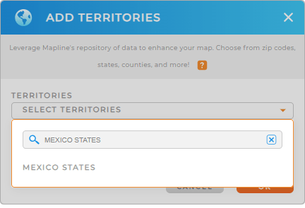
Adding Mexico states on a map is never too complicated. In fact, all you need to do is just to use this simple guide to add territories from MAPLINE’S REPOSITORY.
Don’t forget to utilize the search bar to type in MEXICO and you’ll be directed to MEXICO STATES.
With state boundaries, start discovering untapped patterns in each state. Identify market opportunities. There are a lot of geographical insights that you can get just by making your analysis on a state-wide level.


Pro Tip:
CHOOSE STATE COLORS
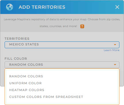
Choose the right color styles for your map to help ignite ideas from location analysis. Mapline got you covered to present different color styles to aid in deeper understanding of state boundaries.
Whether you want random colors for each state, or uniform in color, you can never go wrong with adding colors to present ideas and insights. Additionally, you may want to try applying the heatmap colors or custom-colors from your spreadsheet.
New to this process? Don’t worry, just use this guide to choose color styles for your map. Click OK and there you have it! Your Mexico State map is ready to use to target in-depth state-level analysis.

GET NEW TERRITORY INSIGHTS
What else can you do with your map of Mexico states? Try these capabilities as you analyze data and territories:
- Optimize your business operations with advanced routing
- Generate heat maps to visualize assets, operations data, and market intelligence
- Filter your data on your analysis to reveal new opportunities for growth
Start your analysis now for a better approach in state-level analysis!


