NORTH AMERICA STATES
- Territory Guide
- NORTH AMERICA STATES
Turn a map of North America states into a pool of data analytic learnings now! Once you overlay the state boundaries to your map, get ready to discover new ideas, patterns, trends, and insights for retail, sales, and territory management.
So let’s make this mapping and analytic experience the one that you’ll never forget.
WHAT ARE NORTH AMERICA STATES?
The northernmost countries in North America include:
- United States
- Bermuda
- Canada
- Greenland
- Pierre
- Miquelon
If your business stretches from one state to another, Mapline has the perfect territory for you – the North America States. This is the best territory boundaries to analyze if you want to create a winning sales territory plan. Let’s show you some basic best practices for sales territory management starting on how to easily add the North America states to your map.
ADD NORTH AMERICA STATES TO MAP
The first step is to add territories. Click the ADD button on the left side of your map then select From Mapline’s Repository.
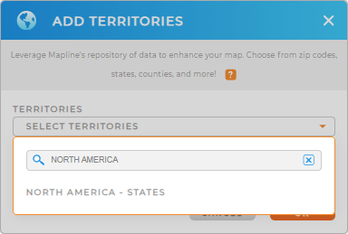
To select territories, use the search bar and type in NORTH AMERICA. Instantly, you’ll get to choose the state territory.
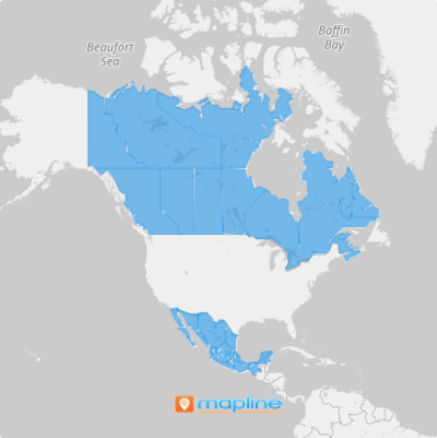
Adding the state boundaries of North America adds to a better visualization to help you see the totality of your network and operations. What’s even better is that the connections you see in your data and state boundaries derive in an informed decision.


Pro Tip: Mapline provides different territory boundaries to each state of North America.
CHOOSE STATE COLORS
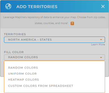
Accelerate your territory analysis the moment you add colors to your state boundaries.
Adding colors makes it easy for you to compare and contrast data within each territory. By having color-coded territories, you get to identify the locations which will be more income-generating, minimize the expenses, and chart the next course where you want to be.
How do you achieve that? Start by selecting the right color style for you, then hit OK.

GET NEW TERRITORY INSIGHTS
Get the best results from your state-level analysis when you apply these capabilities:
- Evaluate the performance of different services by creating segments
- Leverage your existing datasets to pull new columns into a datasets with Mapline dataset
- Assign a maximum number of routes per group with advanced routing
Now, that’s some awesome stuff!!


