
Enhance Territory Analysis by Mapping American Indian/Alaska Native/Native Hawaiian Area
Discover Insights as You Map AIANNH Boundaries
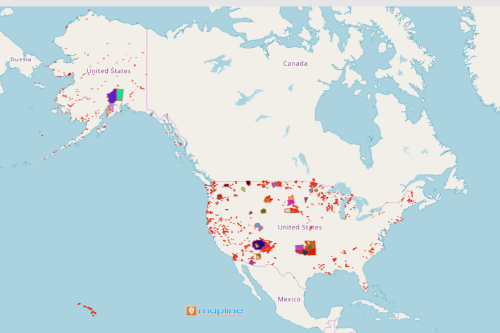
Mapping American Indian/Alaska Native/Native Hawaiian Area is now within your reach! Mapline makes it possible for its users to use unique special territory boundaries in the US. AIANNH or the American Indian / Alaska Native / Native Hawaiian Areas are areas that are federally recognized American Indian reservations, Hawaiian home lands (HHLs), off-reservation trust land areas, and State-recognized American Indian reservations.
Now, with just a few clicks, a powerful territory map can be created. Use this map to segment your location data or run analytics. A territory map is essential in collecting data. More mapping options are available in Mapline to enhance data and territory analysis. For example, try customizing your map pins to intensify the patterns and connections between data. You can also segment your location based data to help you analyze specific data characteristics.
Map US Territory Boundaries in Seconds
Start analyzing your map of Excel spreadsheet data with ease when you overlay a territory boundary such as the American Indian/Alaska Native/Native Hawaiian Area. Here are the only steps to take:
- Create a Mapline account and login.
- Click the orange “Add New Items” button.
- Select “New Map” on the drop down arrow.
- Give your map a name and click “OK.”
- Click the “Add” button from the left sidebar.
- Select the “Territories” option.
- Click “From Mapline’s Repository.”
- From the “Territories” select “U.S. – American Indian/Alaska Native/Native Hawaiian Area (2019).”
- You can also enter that on the search bar.
- Select how you want your boundaries to be colored in “Fill Color” (Random Colors, Uniform Color, Dynamic heat map colors, or Custom colors from spreadsheet).
- Click “OK.”
Sign up now and start overlaying all the US special territory boundaries to enhance your data analysis.