PALAU STATES
- Territory Guide
- PALAU STATES
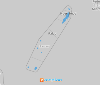
Craft business strategies fused with location insights as you add key perspectives on a map of Palau states. Unlock powerful insights into your customer distribution and competitor locations with a dynamic state map. By visualizing crystal-clear outlook on a state territory map, you’ll be at the forefront of your industry, making data-driven decisions that fuel growth and give you a competitive edge.
Imagine creating this map in under a minute, freeing you to dive straight into strategic planning and taking your business to the next level. Stay ahead of the curve, accelerate your success, and transform the way you approach your market—starting today!
WHAT ARE PALAU STATES?
Palau, a breathtaking island nation in Oceania with 340 islands and 16 states, relies heavily on tourism as its economic backbone. Mapping these states becomes an invaluable tool for analyzing business tourism and identifying trends in each region. Successful brands turn to a map of Palau’s states for sharper analytics and deeper location insights. In a world where data drives progress, leveraging a map of Palau’s states can help businesses thrive. With clearly defined state boundaries, such maps enhance understanding and decision-making.
Get ready to take your analytics to a state-wide level and raise your head above the crowd as you start employing state-level insights into your strategies. Let’s start now!
ADD PALAU STATES
A map of Palau states provides critical insights that can help you take action and get your business to new levels of success. Imagine having the power to visualize your sales data across all states so you can immediately identify high-performing vs underperforming areas. How fantastic is that?
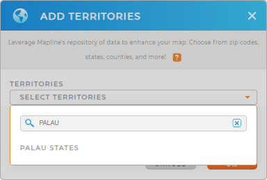
Make this map your tool to accelerate your business to success! Start by adding a new territory from Mapline’s repository. Then, in the search bar, type PALAU to easily select PALAU STATES.
It couldn’t be any easier than that!


Pro Tip: Mapline’s Repository is an inexhaustible storehouse of territory boundaries including Palau states that can be added to your map in seconds. Utilize these precise regional boundaries in your analytics and be amazed by the countless insights you can unlock to help with your day-to-day operations.
CHOOSE PALAU STATES COLORS
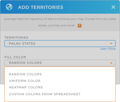
Now, it’s time to decide how you want your state territory map to look. Would you prefer to assign a distinct color to each state, use a uniform color for the entire map, or color-code each state based on your data? Colors are more than just aesthetic—they’re a powerful tool for revealing hidden insights. By using colors effectively, you can uncover patterns that inform strategic decisions, improve sales performance, highlight market trends, and optimize distribution planning.
The right color styling option can transform your map into a key driver of business success. Configure the best territory colors then click OK.

GET NEW TERRITORY INSIGHTS
Uncover hidden insights to enhance your overall business strategies by leveraging these capabilities to your map of Palau states
- Design a smart system that churns out optimized routes in minutes
- Share reports in seconds to keep your team informed 24/7
- Gain deeper data insights as you sort your data by multiple columns


