PUERTO RICO MUNICIPALITIES
- Territory Guide
- PUERTO RICO MUNICIPALITIES
Set your territory and data analysis sky-high when you add Puerto Rico municipalities to your map in just a few clicks! With this territory overlay, you can unlock competitor insights and tap new markets in just a few minutes rather than drowning yourself in reading between rows and columns in the spreadsheet. Leverage a map of Puerto Rico municipalities to enhance data analysis and empower your brand to stay ahead of the curve. By unlocking key insights, you can drive innovation, optimize strategies, and gain a competitive edge in today’s dynamic marketplace.
By adding this territory, you unlock invaluable insights into sales performance, store risks, and competitive landscapes—all in just two quick and easy steps. Get ready to outperform your competition as you leverage your Puerto Rico municipalities map now!
WHAT ARE PUERTO RICO MUNICIPALITIES?
Puerto Rico is an unincorporated territory of the USA divided into 78 municipalities. Since municipality boundaries are smaller in areas, analyzing this type of territory analysis elevates your informed decision-making to assess the current market, improve strategic planning, and more!
Compare your business operations in each municipality and identify areas of improvement. Furthermore, to outpace the competition, compare your business operations with your competitors. Learn why and how one brand may be leading in sales. Understand the challenges and use these insights to innovate and build stronger customer relations.
ADD PUERTO RICO MUNICIPALITIES
A map of municipal boundaries of Puerto Rico drives informed decisions. Identify market opportunities and learn how your competitors operate. Be the brand that people will want to go to when it comes to products and services!
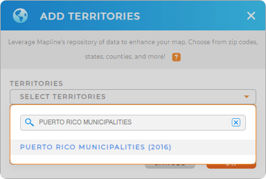
Let’s add these administrative divisions to your map now. Start by adding a new territory from Mapline’s repository . Type in PUERTO RICO in the search bar and select PUERTO RICO MUNICIPALITIES.


Pro Tip: Mapline’s Repository is your go-to analytical toolkit, offering the latest boundaries for Puerto Rico, including municipalities and Puerto Rico sub barrios. By exploring these territories, you can gain valuable insights that elevate your decision-making process and help you craft hyper-local strategies tailored to each area.
CHOOSE MUNICIPALITY COLORS
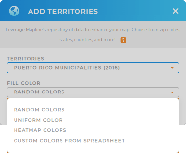
Get to understand municipal territories even deeper by choosing the right color style. To identify each municipality, choose random colors. To visualize market saturation or identify growth potentials, choose heat map colors.
Whatever you choose, there’s always the best color style for you! Choosing the right territory color styles produces a great visual impact that helps ignite location ideas for decision-making.
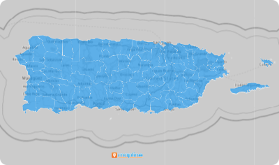
Click OK and there you have it! Your Puerto Rico municipality map is ready to be analyzed anytime, anywhere.

GET NEW TERRITORY INSIGHTS
What else can you do with your Puerto Rico municipalities map? Among many others, you can:
- Assign sales team labels to quickly display the exact information you want to know
- Drive informed decision for the next best marketing strategy when you add your data to your map
- Split your customers into groups with segments


