SIERRA LEONE PROVINCES
- Territory Guide
- SIERRA LEONE PROVINCES
Leverage a map of Sierra Leone provinces for business analysis to enhance your strategy and operations. This level of analysis helps to understand local consumer behavior, preferences, and demographics, allowing you to segment your market with precision. With insights segmented by province, you can tailor your marketing campaigns to address the unique characteristics of each province.
Transform your business analysis and strategy now by adopting a focused approach with province-level mapping. Let’s get you on the journey of adding the province boundaries to your map to start optimizing your business performance with more informed decisions.
WHAT ARE SIERRA LEONE PROVINCES?
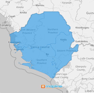
In the heart of West Africa lies Sierra Leone—a country divided into four provinces – Northern, North West, Southern, and Eastern Provinces. A map delineating these provincial boundaries isn’t just a tool; it helps uncover how each province interacts with your data to help you distinguish opportunities to propel your business forward.
By integrating a province-level map of Sierra Leone into your business strategy, you gain a powerful tool for better understanding and crafting effective strategies. This approach ensures that your strategies are both data-driven and tailored to the specific needs of each province, ultimately enhancing enhanced decision-making and strategic planning.
ADD SIERRA LEONE PROVINCES
Add province boundaries with location data on your map, and you can have a powerful tool for making informed decisions and crafting effective business plans. This provides a clear visual demarcation of each province boundary.
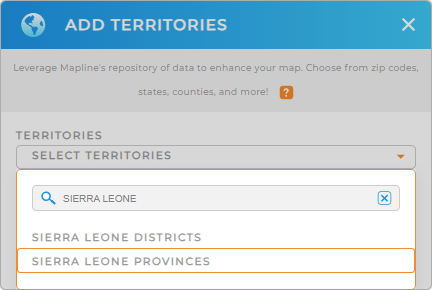
Imagine how quickly you can add Sierra Leone provinces to your map when you add a new territory from Mapline’s repository! Type SIERRA LEONE into the search bar, and select SIERRA LEONE PROVINCES.
With the right territory added to your map, the next step is equally important to create a customized province territory map – that of applying territory colors.


Pro Tip: Mapline’s Repository is packed with territory boundaries from countries across the globe. This is a cornerstone to enhance your territory analysis as you seamlessly integrate various territories, including Sierra Leone districts and provinces, into your map to intensify your global operational reach.
CHOOSE PROVINCE COLORS
In business analytics, colors aren’t merely decorative—they are the key to unlocking profound insights that can redefine your strategy. By applying the right color styles, you’re not just visualizing data; you’re setting the stage for a strategic masterpiece!
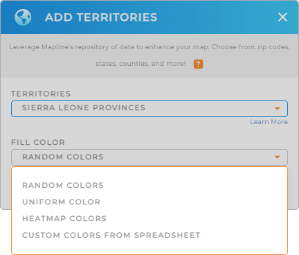
To do that, choose the type of color styles provided by Mapline – heat map, custom colors, random colors, and unified color. Once you have configured your settings, click OK.
Now, there’s your map of Sierra Leone provinces. Go ahead and analyze your data and be amazed by the piles of insights you can instantly gain.

GET NEW TERRITORY INSIGHTS
Now, here are some of the most powerful capabilities that Mapline offers to help you uncover valuable insights:
- Filter your data to view performance metrics
- Add a report to measure sales success, keep an eye on customer behavior, or spot regional trends
- Segment your data to visualize the areas for the highest engagement or sales conversions.


