SINGAPORE DISTRICTS
- Territory Guide
- SINGAPORE DISTRICTS
Make the best use of a map of Singapore districts. Uncover district-level trends and patterns in just less than a minute by leveraging the district boundaries of Singapore.
Take your analytics to the district level now as you discover key factors on education, business, health and so much more! Don’t know how to start? Don’t worry, we’ll guide you through.
WHAT ARE SINGAPORE DISTRICTS?
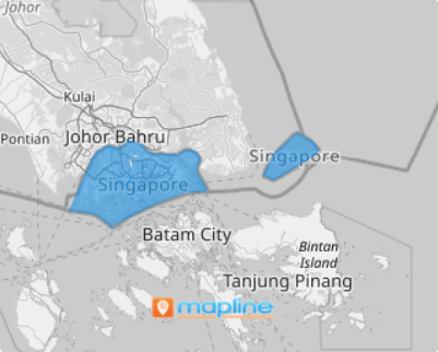
Singapore has 5 CDCs: Central, North East, North West, South East, and South West. The Community Development Council Districts (CDCs) are created to help out in local administration of policies and planning.
Carefully analyze all the district boundaries in Singapore to have a deeper understanding in sustainable development, promote economic growth, and highlight opportunities to ensure that you make smarter and timely decisions.
ADD SINGAPORE DISTRICTS TO MAP
By leveraging the district boundaries, you’re a step ahead of identifying all the important location aspects affecting each district. Just imagine! The power to visualize and analyze factors affecting economic development is now in your hands – only because you have added the right boundaries to your map!
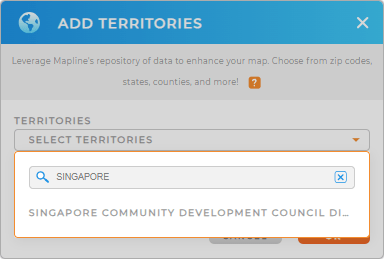
Add a new territory from Mapline’s repository in no time. To ensure that you have the right territory, type in SINGAPORE into the search bar and choose SINGAPORE COMMUNITY DEVELOPMENT COUNCIL DISTRICTS.


Pro Tip: Singapore districts available in Mapline’s Repository are actually the Community Development Council Districts (CDCs). They are designed to help out in local administration of policies and planning.
CHOOSE DISTRICT COLORS
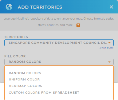
Once you choose your territory, you’ll be guided to apply color styling. This step is especially important to help you ignite ideas that can be used to identify growth opportunities, gain new business perspectives, and a lot more.
Make your Singapore district map a goldmine of ideas that can be used for important decision making! Whatever color style you choose, applying color styles will lead you to understand district territories on a deeper level.
When you’re done, click OK. Easy peasy!

GET NEW TERRITORY INSIGHTS
Stretch your data and territory analysis even more when you apply these capabilities:
- Present essential information when you apply labels
- Fine-tune your drivers’ trip factors through advanced routing
- Pull data from your existing territories to uncover location-relevant insights


