SPAIN MUNICIPALITIES
- Territory Guide
- SPAIN MUNICIPALITIES
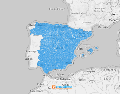
A map of Spain municipalities isn’t just a visual aid—it’s a powerful tool that can unlock a deeper understanding of regional demographic patterns, trends, and behaviors. Armed with georgraphic insights, you’re not just seeing where things happen—you’re discovering the “why” behind them. This kind of insight is invaluable for businesses looking to optimize their operations. With a clear view of customer distribution, you can identify areas where your market penetration is strong and where it needs a boost. You can also make informed decisions on how to allocate your sales teams, ensuring they’re positioned exactly where they’re needed the most.
Create a comprehensive municipality territory map that provides actionable insights. Do that in 60 seconds or less!
WHAT ARE SPAIN MUNICIPALITIES?
Spain is a diverse and expansive country, with over 8,000 municipalities spread across its landscape. Navigating this vast network can be a challenge, but with a detailed map of Spain’s municipalities, you can turn this challenge into an opportunity. For businesses, this map is an essential tool for planning the most efficient routes for your sales team. By strategically mapping out routes, you can minimize travel time and reduce costs, ensuring that your team spends more time engaging with customers and less time on the road.
Tap into the power of leveraging a Spain municipality map today to streamline your routes, and allocate a sales force strategically to drive growth.
ADD SPAIN MUNICIPALITIES
A map of municipality boundaries helps speed up data analysis. Gone are the days when analysis used only spreadsheets, documents, and charts. Do away with daunting and cumbersome analysis by utilizing a municipality map to speed up your analytics!
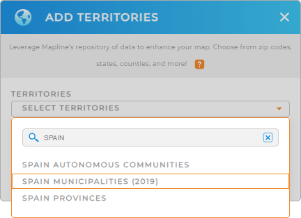
Waste no time as you create a map of Spain municipalities. It only takes a few clicks to do that. Just add a new territory from Mapline’s repository, type SPAIN into the search bar, and select SPAIN MUNICIPALITIES.
That fast, right? Now let’s move on to Step 2.


Pro Tip: Analyze and optimize your operations within Spain. Use Mapline’s extensive list of territory boundaries, including Spain autonomous communities, Spain provinces, and municipalities, to unlock powerful insights that help enhance your global operations.
CHOOSE MUNICIPALITY COLORS
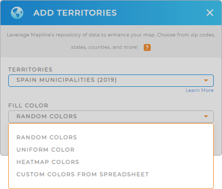
Use colors to differentiate between municipalities to significant value to your territory map. Let’s say you’re a sales manager wanting to monitor the performance of your sales teams per region. You can use static colors to represent the assigned territories for each sales team. Or, use dynamic colors to create a heat map that updates whenever your data changes.
Style your territories with the type of colors that match your analysis. Configure your settings, then click OK. Now, see all the key insights hidden within your map of Spain municipalities.

GET NEW TERRITORY INSIGHTS
Enhance your municipality-level analysis by applying these capabilities to your map:
- Strategize sales and marketing plans with coverage areas
- Add a new dataset to reach out to new markets
- Apply filters to analyze a focused target audience


