THE GAMBIA LOCAL GOVERNMENT AREAS
- Territory Guide
- THE GAMBIA LOCAL GOVERNMENT AREAS
A map of The Gambia local government areas is your gateway to a whole new level of efficiency and growth. Once you add these boundaries to your map, you’ll dive straight into data analysis with precision, uncovering insights that drive smarter decisions and more effective strategies. Whether you want to improve your sales and marketing skills or boost revenue forecasts, leveraging this territory map enables you to get geospatial insights to design the best sales plans.
Ready to boost your efficiency and unlock growth opportunities? Your map is the key to transforming your business!
WHAT ARE THE GAMBIA LGA’S?
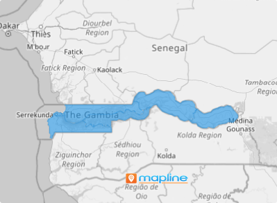
Nestled in West Africa, The Gambia holds the title of the smallest country on the African mainland—but don’t let its size fool you! This vibrant nation is divided into eight local government areas, including its bustling capital, Banjul, a city full of charm and character. Small yet mighty, The Gambia is a unique gem waiting to be explored. When your data is analyzed within these boundaries, you can instantly show trends and provides invaluable insights to tap the local market thereby understanding the purchasing behaviour of customers.
By focusing on these divisions, businesses can discover untapped markets, uncover valuable opportunities, and forge stronger, more impactful customer connections, all while driving sustainable expansion.
ADD THE GAMBIA LGA’s
Let’s add these boundaries to your map in a few seconds. When you’re done, you’re map will be more than just a logistical tool—it’s a strategic approach to pinpointing areas primed for development and growth!
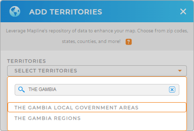
First, add a new territory from Mapline’s repository. Type in THE GAMBIA in the search bar then select LOCAL GOVERNMENT AREAS.
See how fast it is to add the territory to your map? Now let’s move on to Step 2.


Pro Tip: Dive into Mapline’s extensive repository of territories and take your data and territory analysis to the next level! Explore boundaries from countries across the continent, including The Gambia Regions and Local Government Areas, to uncover valuable insights that sharpen your strategies and elevate your decision-making.
CHOOSE LGA COLORS
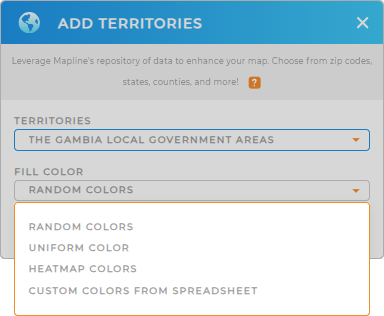
It’s time to bring your territory map to life with colors! Colors are more than eye-catching—they’re game-changing. They uncover hidden patterns, highlight areas to boost sales, reveal emerging market trends, and streamline distribution planning.
Do you want to make each area pop with its own unique color, keep it sleek and simple with a uniform shade, or dive deeper with data-driven color coding that reveals insights at a glance? Let your map do the talking and your strategy take flight as you select the best territory color styles. Then click OK.

GET NEW TERRITORY INSIGHTS
Add these capabilities to open new doors and welcome more insights:
- Reveal significant details about your business when you apply Mapline Data
- Optimize cost-saving routes
- Unveil the factors affecting your locations with coverage network


