UKRAINE REGIONS
- Territory Guide
- UKRAINE REGIONS
Unlock your business’s true potential with a dynamic map of Ukraine regions! This is your ultimate tool for transforming patterns into a game-changing advantage. Stay ahead of the curve by identifying challenges early and making bold, decisive moves. With detailed region boundaries—the most granular administrative divisions in the country—you’ll gain razor-sharp insights into local markets, enabling you to craft strategies with pinpoint accuracy. Address the unique needs of each region, fuel unstoppable growth, and dominate your market like never before.
In just seconds, uncover critical patterns and factors essential for smarter planning and execution. The journey to hyper-local success starts now—take the lead and thrive!
WHAT ARE UKRAINE REGIONS?
Ukraine, a vibrant nation in Eastern Europe, is the continent’s second-largest country, following Russia, which borders it to the east and northeast. As a unitary state, Ukraine is structured into three levels of administrative divisions, with 24 oblasts—commonly translated as regions or provinces—forming the primary tier. While these oblasts serve as the backbone of Ukraine’s governance, their powers are largely defined by the Ukrainian Constitution and national laws, ensuring a unified framework across the country.
Unlock the full potential of your data and enhance your strategies with the power of accurate, detailed mapping of Ukraine regions!
ADD UKRAINE REGIONS
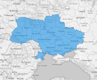
Add region boundaries to your map and unlock a powerful visual tool that transforms planning and decision-making. With clear, defined territories, you’ll gain the insights needed to align your business with the heartbeat of the local market. The result? Not just success—but thriving growth.
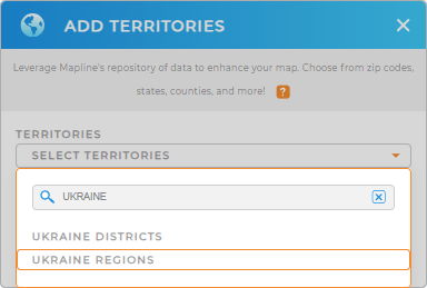
Best of all, the process is quick, seamless, and ready to elevate your strategy in no time! Just add a new territory from Mapline’s repository. Type UKRAINE in the search bar and select UKRAINE REGIONS.
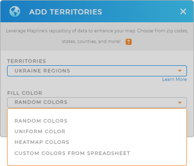
With the right territory, let’s turn your attention to the final step–color styling.


Pro Tip: Explore Mapline’s expansive territory repository, featuring hundreds of worldwide territories, including Ukraine districts and regions. By mapping these precise territory boundaries, you’ll elevate your analysis, gaining deeper insights and sharper clarity for smarter decision-making.
CHOOSE REGION COLORS
Custom territory styling elevates your map into a dynamic tool that blends visual appeal with crystal-clear data insights. By turning your data into an engaging visual story, you empower yourself to make informed, strategic decisions that deliver impactful results.
Whether you opt for random colors, uniform shades, heat maps, or custom palettes, the right color styling brings critical information to the forefront effortlessly. It’s more than just making your maps look stunning—it’s about simplifying complex data for quicker, smarter insights that drive success!

GET NEW TERRITORY INSIGHTS
Refine your approach with these capabilities that turn data into action:
- Optimize delivery routes to ensure that your operations run smoothly
- Tailor your reports to highlight key metrics, trends, and actionable findings
- Customize pins to achieve a clear visual of market dynamics


