U.S. BLOCK GROUPS
- Territory Guide
- U.S. BLOCK GROUPS
Unlock precise market insights by mapping U.S. block groups on your Mapline map. Block group boundaries give brands a closer look at customer demographics, buying patterns, and local trends – essential for effective territory management. This granular view is especially beneficial for companies in sales, marketing, and service delivery, as it enables customized customer engagement, efficient market expansion, and optimized resource allocation. Gain hyper-local insights that support strategic decisions and fuel growth by creating this territory map!
Let’s dive into how U.S. block group mapping can bring a new level of insight to your analysis.
WHAT ARE U.S. BLOCK GROUPS?
U.S. Census Block Groups, defined by the U.S. Census Bureau, are clusters of census blocks that fall within specific census tracts and typically include 600-3,000 people. As of the latest census, the U.S. contains over 217,000 block groups, each representing a unique geographic area. These boundaries offer a granular level of demographic and economic data, making them valuable for understanding customer behaviors and local market trends. For businesses in fields like sales and marketing, block group-level analysis enables targeted customer segmentation and localized strategies that would be less precise with broader territories like states or counties.
Mapping U.S. block groups offers brands highly detailed insights, making it easier to identify potential growth areas and make data-informed decisions.
ADD BLOCK GROUPS
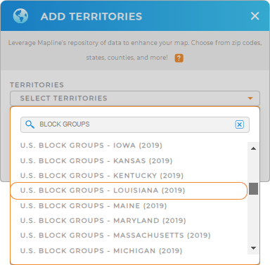
Adding U.S. block groups to your Mapline map gives you a detailed framework for tracking customer demographics, mapping target areas, and planning strategic outreach. This precise setup supports businesses in optimizing territory management and aligning their strategy with regional demand. To get started, add a new territory from Mapline’s repository, enter BLOCK GROUPS in the search bar, and select your desired state from the dropdown list.
With block groups displayed on your map, you’re ready to optimize territory boundaries, perform distance analysis, and plan for targeted growth.


Pro Tip: U.S. Block Group boundaries are kept up-to-date with the latest data from the U.S. Census Bureau. This ensures that your analysis reflects the most current and accurate geographic data available for in-depth local insights.
CHOOSE BLOCK COLORS
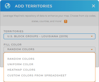
Choosing color styles for U.S. block groups on your map is an effective way to enhance data clarity and uncover hidden insights. Applying random colors helps to visually differentiate block groups for quick recognition, while uniform colors offer a more streamlined look. By color-coding your map, you create a visually dynamic display that makes it easy to identify customer clusters, prioritize resources, and visualize high-impact areas.
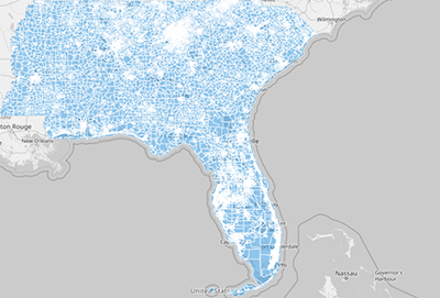
Once you click OK, your map transforms into an actionable resource for territory analysis, helping you turn complex data into clear, strategic insights.

GET NEW TERRITORY INSIGHTS
Unlock the full potential of your U.S. block group map with Mapline’s advanced capabilities:
- Identify market potential and assess service reach by using coverage areas for a detailed visualization of local factors
- Improve customer experience and boost efficiency with optimized route planning for customer visits
- Access key data points on each block group by adding folder reports to your map for seamless territory management


