U.S. CITIES AND TOWNS
- Territory Guide
- U.S. CITIES AND TOWNS
Unlock valuable insights with a map of U.S. cities and towns to revolutionize your sales territory programs. Mapping U.S. cities and towns unlocks a new level of analytic power. It’s your gateway to spotting regional trends, empowering you to design hyper-local marketing strategies that resonate deeply with each community. Plus, it helps you streamline logistics with pinpoint precision, ensuring your operations are as efficient as they are impactful.
In just minutes, you can create detailed territories on your maps, freeing up more time to focus on high-impact tasks like sales planning, strategic development, and territory allocation. Empower your teams with innovative tools that streamline operations and set the stage for success!
WHAT ARE U.S. CITIES AND TOWNS?
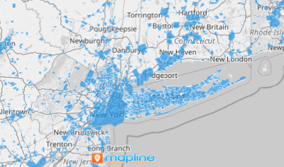
City and town boundaries represent key geographic regions across the USA, and mapping U.S. cities and towns opens the door to powerful spatial analysis for brands. With this data visualization, you can answer critical questions like where, what, and how, and uncover insights that drive strategic decision-making. For example, a well-crafted territory map can reveal hidden relationships and connections between locations—giving your brand a competitive edge when designing operational plans, market strategies, and business initiatives.
Discover the story behind the map and turn insights into action!
ADD U.S. CITIES AND TOWNS
By adding city and town boundaries, you can instantly visualize territory insights! The insights you gain can be used to develop marketing research and strategies, analyze trends, and plan for effective delivery routes.
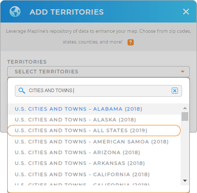
You’re just a few clicks away to add a new territory from Mapline’s repository! In the search bar, type CITIES AND TOWNS. There’s an option to choose ALL STATES. But if you want to focus on one particular state, you can choose that state with cities and towns.


Pro Tip: Mapline’s repository provides the latest city and town boundaries from the U.S. Census Bureau. Select the most recent year to get the most up-to-date boundaries.
CHOOSE CITY AND TOWN COLORS
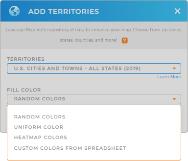
Now we’re just warming up. Watch how your analysis turns from time-consuming to time-saving when you apply territory colors. Strategic color usage doesn’t just make your maps more attractive; it transforms them into digestible, actionable narratives that resonate with your audience.
With the right color styles , uncovering valuable insights becomes effortless—no more spending hours wrestling with data.
If you’re completely satisfied with the result, just click OK and your US cities and towns map is ready to use.

GET NEW TERRITORY INSIGHTS
With your territory map of cities and towns, see your data with fresh eyes as you overcome geospatial problems using the following:
- Seamlessly optimize the best routing system to cut significant amount of time in your deliveries
- Emphasize stores with the highest sales through heat mapping
- Perform advanced calculations to understand how your data relates to your territories


