NEW ZEALAND REGIONS
- Territory Guide
- NEW ZEALAND REGIONS
Create a map of New Zealand regions and unlock the full potential of your business analytics! Mapping out these precise region boundaries allows you to identify geographic patterns that impact your territory plans, local government processes, and civic and political engagement. Mapline’s clear and impactful territory visualizations are guaranteed to help your team build and manage location-savvy sales territories.
Mapping New Zealand’s regions provides detailed insights that enable you to make data-driven decisions, enhance strategic planning, and optimize operational efficiency. Start leveraging these powerful visualizations to uncover growth opportunities and stay ahead in today’s competitive landscape.
WHAT ARE NEW ZEALAND REGIONS?
New Zealand is divided into 16 regions, each with its own unique characteristics and economic significance. These regions include Auckland, Wellington, Canterbury, and Waikato, among others. Each region varies in population density, economic activities, and industry hubs. Mapping these regions provides valuable geographic insights that can significantly enhance your business analytics. For example, Auckland is the largest and most populous region, serving as the country’s main economic and commercial hub. Wellington, the capital, is known for its governmental and administrative functions. Canterbury is an agricultural powerhouse, while regions like Waikato are key to manufacturing and logistics.
By incorporating New Zealand’s regions into your map, you gain a clearer understanding of regional dynamics that impact your business. This helps in building stronger customer relationships, increasing lead generation, and avoiding costly delivery errors.
ADD NEW ZEALAND REGIONS
Incorporating New Zealand’s regional boundaries into your map offers numerous benefits. It provides a detailed overview of your sales territories and operational reach, enabling more precise and effective decision-making.
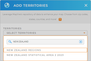
To add these regions, simply add a new territory from Mapline’s repository, type NEW ZEALAND into the searchbar, and select NEW ZEALAND REGIONS.
This step gives you a comprehensive view of your business landscape, helping you better understand regional dynamics.


Pro Tip: Mapline’s extensive repository includes a wide range of global territories, including New Zealand statistical areas and regions. Take advantage of this powerful tool to map other regions of interest, allowing you to gain deeper insights and make more strategic decisions on a global scale.
CHOOSE REGION COLORS
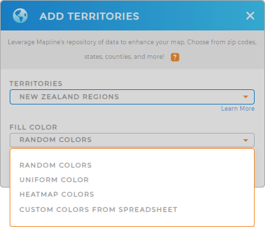
Color-coding New Zealand’s regions is essential for enhancing data visualization and business analytics. Assigning colors helps you quickly identify regional trends, performance metrics, and areas requiring attention.
Simply choose your preferred color styling, then click OK.
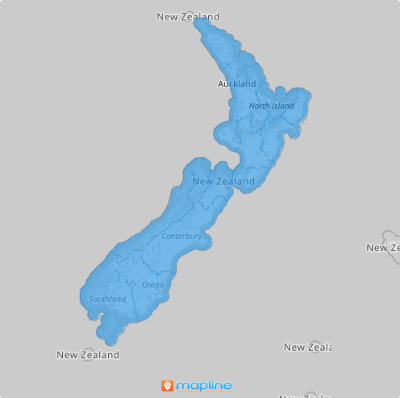
Now, your map is ready to go! This visual distinction makes data interpretation easier and supports more effective business strategies.

GET NEW TERRITORY INSIGHTS
Unlock additional insights by leveraging the powerful capabilities of Mapline. Beyond mapping, you can enhance your analysis with various advanced tools:
- Analyze your data faster when you hone in on specific filter categories
- Sort and organize your data by your preferred criteria for deeper analysis
- Create heat maps to visualize data density and trends across regions


