Brazil Meso Regions
- Territory Guide
- Brazil Meso Regions
Add Brazil mesoregions to your map and unlock powerful new insights! Gain valuable context on market dynamics, distribution patterns, and demographic trends across Brazil. With a clearer understanding of geographic nuances, companies can make data-driven decisions, optimize resource allocation, and identify new opportunities for growth.
Ready to elevate your strategic planning? Let’s dive in and explore the potential of Brazil meso regions on your map!
WHAT ARE BRAZIL MESOREGIONS?
Brazil mesoregions are large geographic divisions within Brazil, consisting of multiple microregions and serving as intermediate administrative units between states and municipalities. Mapping Brazil mesoregions can facilitate enhanced operations and analytics.
For example, a logistics company could optimize routes and resource allocation by leveraging insights into regional transportation networks, infrastructure, and geographical features. A territory analysis of Brazil’s mesoregions can easily enhance their logistics operations, minimize delivery times and costs, and improve overall efficiency.
ADD MESOREGIONS
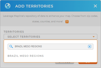
Unlock new opportunities, streamline resources, and expand your market presence by mapping Brazil’s Mesoregions. Quickly visualize the impact of local trends and characteristics on your brand! First, add a new territory from Mapline’s repository.
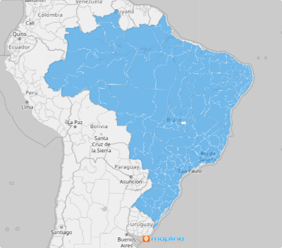
Next, type BRAZIL MESO into the search and select BRAZIL MESO REGIONS. And BOOM! You’ve added a new layer of territory boundaries to your map.
You’re almost done! Let’s move on to Step 2.


Pro Tip: Tap into Mapline’s vast, worldwide repository of territory boundaries in Brazil, such as Brazil microregions, Brazil states, or Brazil municipalities. The possibilities are endless!
CHOOSE MESOREGION COLORS
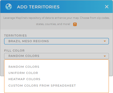
Now, you can customize your map with custom fill colors! Make your territories uniform with a single color, or color-code each territory in a different color.
This is a great way to get the precise information you need in a single glance. Just select the type of colors you need, then click OK.
And you’re ready to go! Wasn’t that easy?

GET NEW TERRITORY INSIGHTS
Now, you’re ready to make the most of mesoregion-level analysis! Here are some powerful ways to get startedd:
- Create the most optimized routes and cut back on travel time and mileage
- Set up a dynamic powerhouse tailored to meet your specific needs
- Seamlessly link your Google Ads account with your Mapline dashboard


